Showing posts with label Phetchabun. Show all posts

Wednesday, May 18, 2011

Barking up a tree

Ahh, another spelling mischief. Sap Chomphu, Sub Chom Phu, Subchom Poo, pronounciation same-same, just too difficult to spell ...

Anyway, another Phetchabun province waterfall. Not located in a national park, administratively it is seen as an arboretum with waterfall. Or a National Forest Reserve.
Barely 30 ha in size.

Getting here is not too difficult, located 8 km south of Nong Phai on highway 21, the access road is from the village market, due west. Just slow down in the village and take the only road west, once on this road there are signs virtually every km, for the 8-9 km it takes to get here.

The road gradually rises as it dissects mango orchards. Late April, the farmers are up early and the road is used as collection unit for the plastic containers full of mangoes, waiting for transport to Bangkok undoubtedly.
Despite all the signs along the way, the last one directing you to take a right before the steep incline is non-existent. On this cross road though is a wooden sign which describes this as Sap Chom Phu Arboretum.

Past a few houses one enters along a now empty pond. Behind this are lined a serious amount of stalls and an expansive parking area.
No entrance fee is required and one wanders across the bridge. Not many foreigners get this far. This I conclude as the number 1 tell-tale sign, a pack of dogs is barking at the exotic creature (must be a ghost), is all too clear. From beyond the bridge there are a number of trails heading up and I just take one.

Within 2 minutes I am walking alongside a small stream (Sai Ngam Ngam) under huge trees, the trees alone are worth a visit. Some larger examples have been singled out for the yellow ribbon worship.

However the stream itself is a trickle and despite walking as far as possible, the waterfall is only a number of short steps.
Possibly these are part of the three waterfalls mentioned as per Bangkok Post.

Waiting for the rain(s)

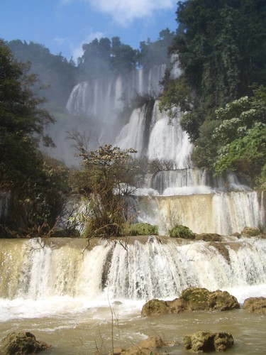
It's evident that later on, in the rainy season, there are much bigger falls to be experienced, see the picture of a full size poster at the entrance of the falls (below); despite an overnite downpour there's little to be seen, let alone experienced.

My photo's posted here are quite similar to those of the Bangkok Post referenced above, in the absence of the big waterfall.

What it should look like

In all it seems a little depressing as extensive amounts of trash take the shine off the naturalness of the surroundings. Better management might be an idea ...


More photo's from this provincial
blog.

Monday, May 2, 2011

Horn-billing


Phetchabun province is just over 4 hours easy drive from Bangkok, but it's a great place to visit which (despite it's proximity) still receives next to no tourist; even Lonely Planet doesn't mention this beautiful province!

In essence, Phetchabun province is a wide north-south valley, crammed between at first hills, later on 1000+ m, so no wonder that waterfalls are a major feature, though surprisingly scarcely visited.

One of the lesser known national parks in Phetchabun is that of Tat Mok, considering that the province also contains the Hin Rong Kla national park. The 290 square km Tat Mok National Park is named after it's signature waterfall which is said to be a 1-level 200-300m high waterfall

Getting here is not too difficult, from Phetchabun town head southeast and take road no. 2271 until it reaches road 2275. A right turn is required and then quite quickly the entrance to the park will need a left turn. From the entrance it is 18 km over a mountainous road to the road head.

Not many foreigners make it this far up-country and after the ticket lady contains her surprise thereafter followed a frantic scram (involving 4 staff members) to find the correct 200B entrance tickets, nearly 7 $US (April 2011).


It takes about half an hour to drive the deserted road to it's ultimate destination. Going up there are two larger viewpoints, if clear one could easily see Phetchabun town. After the first hill there are some more offices and a campground, beyond seems to receive even less visitors. At a certain moment I need to get out and remove a large branch from the otherwise good road. The valley gets more narrower and ends at a small car park with some amenities, but no one seems to be hanging around on a late Monday afternoon.

The track then starts and should last for nearly 3 km, 45 minutes. It's not often that in Thailand there are long walks possible (Thai's prefer drive-in nature) and certainly not well signposted ones. The trail hugs either side of the stream and has seen better times. On narrower sections, the improved pathway has been washed away as do all bridges. Attempts have been made to keep the track passable and it really is a nice beautiful walk.

An improvised bridge

Finally one comes to a section where the trail splits, the lower path continues onward for another 200m to the Song Nang waterfall (or Songnang)whereas the higher steps should take you to Tat Mok.

As rain is threatening with clear intentions of today's daylight being curtailed, I skip the Tat Mok part, as it is a high waterfall but with little water.

Instead the Song Nang waterfall is in front of me. It's a 10 level waterfall with delicious pools to skin dip in, yeah!


Author chillin

After chilling out it's time to return, drops of rain are falling. The best part of this is that birdlife are welcoming the moist and are out in numbers, audible though not visible. A salvo of larger cries leads me to believe that horn-bills are overhead and low and behold at an opening I see no less than 10 juveniles frolicking in the tree tops.

Back at the end of the road, there is still a great place to rinse off the return sweat before returning to civilization.


There are a couple of web sites on Tat Mok, mostly poorly translated from Thai, resulting in a load of gibberish, see for instance
'Tat Mok - two waterfalls her'.
sbayura.com has a good posting on Tat Mok / Song Nang including extensive photo's.
Thaiways has a picture of level 6.

Nearby is the hot spring of Nam Rong, possible as a post walk soak.

Wednesday, December 9, 2009

Thailand's Best?

Ti Lo Su, Umphang, Tak province. By spannar00oi

The Thai language Places and Prices coffee table magazine published an issue 2 years back with top Thailand destinations. These were their choice of best waterfalls, without ranking:
  • Klong Thom Ron waterfall (being a waterfall as well), Krabi, Southern Thailand
  • Huai Khamin waterfall, Kanchanaburi, Central Thailand
  • Thi Lo Su, Tak, Northern Thailand
  • Thi Lo Re, Tak, Northern Thailand
  • Khlong Lan, Kampaeng Phet, Central Thailand
  • Tat Mok, Phetchabun, Central Thailand
  • Saeng Chan, Ubon Ratchathani, North-Eastern Thailand
Saeng Chan waterfall makes the list because it goes through a hole in the rock. Photo source.
  • Mae Surin, Mae Hong Son, Northern Thailand
  • Heo Narok, Nakhon Nayak, Central Thailand
  • Phraiwan, Phattalung, Southern Thailand
  • Krung Ching, Nakhon Si Thammarat, Southern Thailand
  • Ton Nga Chang, Songkhla, Southern Thailand
  • Mae Ya, Chiang Mai, Northern Thailand
There are probably many more that could of made the list. It's not mine. They may have tried to include all regions and be politically correct ....
Related Posts with Thumbnails