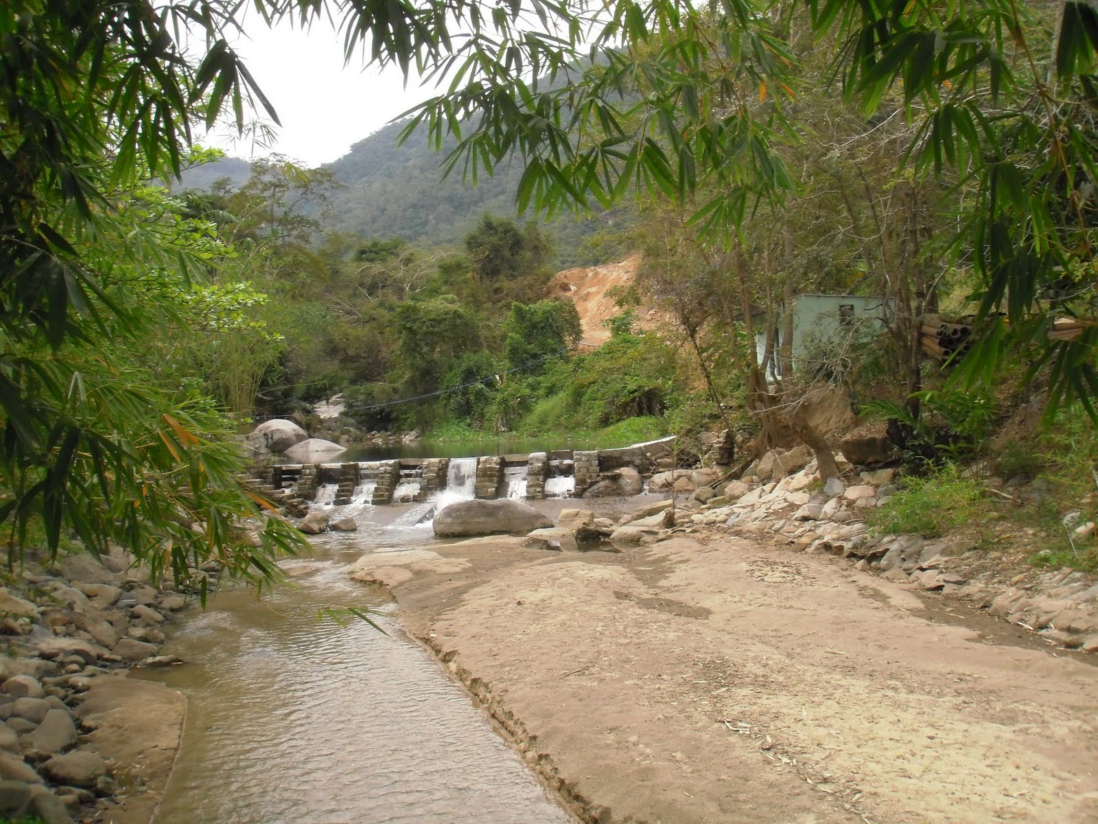
Tuesday, April 19, 2011

Updates

It's probably the first time I have used this blog for updates. Usually if there are updates I add them to the postings, keeping everything much more current.

However, it's not common for waterfalls to make news headlines and unfortunately it's mostly for the wrong reasons.
From
addyjagat an extensive article on the death of a British women who fell down 100m on the Ton Nga Chang waterfall, 25 km from Hat Yai, southern Thailand.
'... slid about 30ft down the sloping rock-face before plunging off the steep 300ft drop'.
We tend to forget that waterfalls can be dangerous and the above is just another wake-up call. No doubt the authorities will come with extensive measures to avoid this happening in the future, though warning people always seems to be the most sensible.

Horrific and tragic.

Other news worth mentioning is that travelfish blogs are getting entries on waterfall hunting around Chiang Mai, up to now two great entries.

Monday, April 4, 2011

Past the bear pit


Part of the Yang Bay Tourist Park complex or at least just outside the most developed part of this tourist development complex, Ho Cho waterfall is a wide low waterfall, in all descending 6-8 m. I guess. Below is a great pool where one can take a very undisturbed swim. At least during the week, when visitors are few and far between.

That's for now. It's quite strange, this lack of even a decent track, slam-bam next to Yang Bay Tourist Park. Instead of going to Yang Bay waterfall itself, once inside the 'park' one takes the left road past the bear pit, tribal game place and orchid garden. Abruptly the wide road stops (10 minutes after taking the road) at a wild stream.

A small path continues through the high grass to the river where a small log has been laid over the first 2 m of the river crossing; the rest can be achieved by jumping from rock to rock. On the other bank of the river, the track continues through the forest until it hits the rock-face of the waterfall itself. No track beyond this by the look of it. Time for a dip.


The Yang Bay Tourist Park companies brochure describes Ho Cho as follows:
‘To be deep in the forest. Ho-Cho waterfall is considered as a challenge to visitors. Ho-Cho waterfall also owns a lot of hot mineral water sources helpful for cure’.
Well, the effort required can not be described as a challenge, it is pretty easy. I'm unsure about the hot spring claim though, it certainly was not apparent.

Another link to the possibility of there being mineral water is here:
'After a refreshing dip, visitors can relax in a natural hot spring'.
As stated in the Waterfalls of Southeast Asia blog entry on Yang Bay, management may want to expand the mineral water on offer and add in some mud (as in the success of Thap Ba hot spring).

It's a pity that not much is made of the current mineral water facilities, if existing.

Despite the development, Yang bay and certainly Ho Cho are worth the effort.

Update [June 2012]
This article mentions 
'The waterfall [Ho Cho] includes two streams, one hot and one cold. If tourists fancy having fun in the hot water or just want to relax, the park management board has built a swimming pool, which mixes the two streams of hot and cold water.
The waterfall will soon be developed into a hot spring site'.
All part of an expansion ...

Monday, March 28, 2011

Tax man. Not.


It's not often that a waterfall is included in this blog which I didn't go myself, in fact this is a first.
My wife was in Cambodia's western province of
Pailin, not a place often visited. There she visited the Olavao waterfall, on her way back from Pailin.

There's some confusion on the name.
Travelfish notes it as Otavao:
'If you're going to spend the day in Pailin, Otavao Waterfall is the area's top attraction. It's an easy trek to the top with several different sets of stairs along the way that lead down to the falls.
An unnamed restaurant is at the top and offers Khmer food and cold drinks. It's a great place to rest as it overlooks the falls and offers marvellous views of the surrounding lush scenery.
Several canopies are dotted along the falls and serve as good spots for resting or a picnic. It's best visited during rainy season, but either way, you'll likely have the site to yourself'.
O Tavauv is what the falls are according to Zepp (2):
'The falls are privately owned, by none other than I Chien, govenor of Pailin and son of Ieng Sary. This is not a National Park, and is yet another example of the Cambodian elite using their official position to further enrich themselves. And yet, they are performing a public service. It is the same system that cannot collect taxes for education but which gives you Hun Sen schools'.
Zepp goes to say that there are in fact seven falls.

This website mentions O'Tavoa.


Matt Jacobson's (2) describes how you need to return to just outside Pailin (under 2 km) and turn to your right. After 4+ km there's a ticket booth and then it's nearly another 3 kms before you reach the waterfall. Matt mentions it as being a 4-tier waterfall, but my wife said there were many tiers ...

Some great swimming holes and during the week it's near-deserted. Though recent construction of access roads and stalls and mountains of garbage indicate that in weekends the story is different.


Despite not swimming herself my wife did indicate that the swimming holes were big ...

Notes:
(1) Jacobson, M. (2008) Ultimate Cambodia. Coastal Books, Phnom Penh, Cambodia
(2) Zepp, R. () Around Battambang. 2nd Edition. Tean Thor association, Battambang, Cambodia.

Wednesday, March 23, 2011

Cemented this one


Docile
It’s always difficult to present nature in it’s original state to tourists, such that it is appealing. Apparently, in Vietnam nature is required to be conquered before it can be appreciated. Conquered by the masses.


Yang Bay waterfall ("waterfall of the heaven") ranks as
Khanh Hoa’s number one inland tourist location. Why? Because it’s been tamed and enhanced?

Enhancing includes a bear pit, a crocodile enclosure and a fish lake. An area where one can experience local ethnic customs, such as pig racing. And listening to a music performance by the local Raglai:
'Gia Rai residents are proud of their musical ability and are only too happy to entertain visitors. They play traditional instruments such as the chapi, t’rung, tacung flute, taleploi clarinet and the dan da (stone instrument)'. source
Taming means wide lanes and lots of cement. Making (and applying) rules. And cordoning sections off to make sure the masses stay docile ...

But it’s a waterfall! Hmmm.

Entrance
Located at nearly 50 km west of
Nha Trang, the capital of Khanh Hoa, currently the access road heading west is being reconstructed. In absence of the completion one needs to take the only other road west, Highway 26A (to Dalat) which goes through the 17th century citadel of Dien Khahn. Eventually one heads more southwards into more hillier terrain, the hills covered with cassava and sugarcane.

Then over a higher hill one suddenly is at Yang Bay with it’s wide tree lined roads. One parks close to the ticket office (30,000 VND, ~ US$ 1,50) and as with me I apparently also bought a ticket (another 10,000 VND) for inside the park transport.

A golf cart brings me up 300m to a place closer to the falls.
Here’s a restaurant and a number of outlets selling everything but a good cup of coffee. This being an early morning through the week visit, it’s nice and quiet. Hardly any visitors and a lot of cleaning going on. It certainly is clean; hurray for businesses taking over the nature.

About 100m beyond the stop the road is back at the level of the stream. On the other bank of the river is a smaller waterfall called Yang Khang which functions as backdrop to the above mentioned music show.

Yang Khang waterfall, note that one is not allowed on the rocks themselves ...

Yang Bay
In the mainstream is the Yang Bay waterfall: a wide fall of a number of steps, going down by as much as 20m. A wide path brings one to the top of the fall where it’s probably intended to take a photo and return back to civilization.

Beyond this point is a wide boulder strewn valley floor, which provably extends for a lot further. Travelfish describes there being another set of falls about a kilometer up.
Instead of seeking this other set, I decide to see if another waterfall closeby, Ho Cho is reachable. See the upcoming blog entry on this fall.

Yang Bay

Even though over-commercialized and sanitized, Yang Bay is still worth the visit; at least if there are not too many visitors. Lines have been set out showing where one can (or must) swim and it’s certainly safe, albeit overly civilized.

First hand experience by other visitors is not easily to come by. Travelfish mention:
'The main falls have been heavily modified, and some swimming areas have been artificially created, but the effect is fairly natural and quite beautiful'.
Wikitravel adds:
'It used to be a lot nicer before they built it but it is still a very nice place to visit'.
Under-construction
The current situation is only a situation which consists from mid-2008, when the part underwent an upgrade to the original construction of 2004 (source). The owner of
Yang Bay Tourist Park is the company known as Khatoco. Besides industrial activities and the local professional football of Nha Trang, it is responsible for the 570 ha park. In a news item the company is said to have more plans:
'We plan to invest billions of dong in Yang Bay. We want to build a mud bath and a high-end resort,” Khanh said with a smile surveying the beautiful countryside. “Then more people will be able to enjoy the nature and the loveliness of the reserve'.
Hmmm, I might have some reservations of this type of tourism which caters to masses. Then again, commercial interests have some potential unforeseen consequences:
'Le Cong Ra, director of the Yang Bay Tourist Park, said he and his subordinates are very worried knowing that loggers are destroying the forest in the upper part of the Yang Bay Fall'.
The outcome is more stringent enforcement.


You are here. At the cross road. Left to Ho Cho, straight ahead Yang Bay and Yang Khang.

Monday, March 14, 2011

Falling Fairies

Entrance to Suoi Tien

Fairies
Suoi Tien is a commonly used name for a water-like attraction in Vietnam. Suoi meaning stream, Tien meaning fairy. So in English not as straight forward as commonly thought. Fairies are an often recurring theme in Vietnamese legends and with Suoi Tien, Khanh Hoa province the legend goes as follow:
'Legend has it that a giant from Binh Dinh Province visited Suoi Tien thousands of years ago. Enchanted by its charm, the giant accidentally slid into the stream. One of his feet landed on a boulder on the bank of the river, flattening it to create a smooth surface in the middle of the stream. The flat stone served as a place for fairies from heaven to play after coming down to earth for a swim. The flat stone is now an ideal resting point for visitors who want to conquer the upstream flow of the river'.
Note that the website from which I gained this insight has a photo of another stream (possibly for fairies) presumably more south (Mui Ne?).

The stream at entrance, with man-made pool.
Note the extensive scarring beyond, a sign of times to come


Getting There
Anyway, this Suoi Tien is located not so far from Nha Trang, the provincial capital. Passed the
17th century citadel of Dien Khahn one takes a left and continues towards the hills, sign boarding is unpredictable. There is also a number of internet sites that imply taking a turn from highway 1, south of Nha Trang in the village of Suoi Dao.
And finally a new by-pass is being built which will alter the directions altogether. The final 1 km up to the foot of the mountain
is a poor road , though small scale repairs were underway. A total of 20-25 km from Nha Trang (45 min.).

Plans are being drawn up, according to this reference:
'under a 15 year plan to build hotels, bungalows, regenerate forest, etc'.
So by then it should be less difficult to find!
Considering the amount of scarring this process (construction) is already resulting in (see photo above), the regeneration part will probably entail a long term restoration of what they had initially undertaken.
Sims [1] adds:
'Past the parking area a bar, restaurant, and tourist office are under construction. This once hidden gem is under wraps no more!
…
The downside to tourism is evident in all the litter seen strewn about, despite the odd rubbish bin'.
Other references are less expansive. LP [2] has a short paragraph on Suoi Tien:
'This enchanting spring seems to pop up out of nowhere.
…
It has been earmarked as the next big ecotourism site, which paradoxically probably means massive over-development, but it is still peaceful if you hike upstream'.
Anyway despite the nearness to Nha Trang and the obvious attractiveness for recreation, a week day mid-morning, March 2011, sees little or no crowds at all, quite sleepy.

Experience
An entrance fee is required (10,000 VND; ~ US$ 0,50) and then ione can wander up the stream. Despite aforementioned plans, there's still hardly anything to be had, at the entrance; even buying a drink is only just do-able.

The first set of falls which have been enhanced see a large crowd of drunk local teenagers, but continuing onwards through the stream bed one can seek solitude easily.

Enhanced

There's a passage below an overhanging rock and at a certain place an inlet for drinking water. Continuing through the bed stream brings one in still quieter places, though refuse still bears witness to a superior (?) civilisation.

Finally I find a nice sun drenched sandy pool and take an au-naturel plunge and reconnect with my inner-self. Birds everywhere, a nice place indeed.


More
Though not a waterfall in the strictest sense, it does contain many drops of a meter or more. There are a lot of pools to cool off in and if motivated one can continue onward up the mountain.
Sims [2] describes continuing as follows:
'Locals say that if you follow the stream to its source, about a two day hike, you’ll reach a magical chess board used long ago by fairies’.
Closeby is another stream, Suoi Nguon which according to Sims [1] misses the extensive development of the other nearby sites (see Ba Ho and Yang Bay) and signifies
‘it’s peaceful atmosphere with little to no other people around’.
Suoi Nguon can be reached by taking the road up Hon Ba mountain. Some pictures of Suoi Nguon are to be seen from this
web album.

Notes:
[1] Sims, A. (2010) Nha Trang Guide Book 2011-2012 Edition
EBT Media, Nha Trang, Vietnam.
[2] Ray, N., Y.-M. Balasingamchow, I. Stewart (2010)
Vietnam. 10th Edition. Lonely Planet, Footscray, Australia

Related Posts with Thumbnails