Saturday, March 5, 2011

Intoxicating?


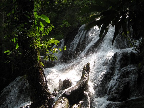
Suoi Ba Ho translates as "Three Pools Stream", which seems to give more credence to the waterholes beneath the three falls. In quick succession these falls find their way down about 100m of granite, hollowing out their lakes and creating a number of great swimming holes.

Unfortunately access is not fantastic. The turnoff from Vietnam's Highway 1 is 20-22 kms north of Nha Trang, the Khanh Hoa provincial capital, located on the south central coast. There’s a larger sign just before the small surfaced road. Three kilometers it says, which implies possibly 3 kms until a T-crossing with no sign there but where one needs to take a left. Continue onwards for about another 3 kms over a poor rough and tumble road, one eventually ends at a car park, in the process of being built into a bungalow park.

Well-shaded by tall trees, the rudimentary car park is along a sluggishly moving stream. On the opposite side are also bungalows being built, certainly marks of forward planning. Vietnamese ecotourism. The best part is that this is the worst part of whatever this development entity calls itself.
A quick payment of 20,000 VND (a fraction less than a US $) had ensured entrance but the destination was still a little upstream.

A wide track continues along the stream until it shortcuts a turn and hits the boulder strewn stream itself. From here to the first fall one needs to jump from rock to rock. One gets to the first lake (and fall) after about 45 minutes from the car park.


Surprisingly for a Tuesday mid March, there are two large groups of locals at the lower lake having a merry time, slowly getting intoxicated.

Did I tell you that the National Parks of Thailand want to ban alcohol consumption in their jurisdiction? According to the Nation (December 28 2010) On the one hand, that leaves us folks who can control our intake with empty hands, on the other hand, drunks playing the clown are a part of the past.

Anyway, there’s a track up the side of the canyon, a very steep track. Fifteen minutes up and it’s a steep slide back down. There is also the possibility to use metal rungs drilled into the rockside to pull oneself up to the next features. Up here there’s nobody to be found, a great place to dip the skinny, a personal first for me in Vietnam.


More info from internet are the pages on Ba Ho Falls:
'Therapeutic properties are attributed to the waters of the three pools at Ba Ho Falls'.
Asian waytravel:
'Ba Ho is primitive with its tortuous soil paths, grass covers and green trees drooping down to the rock bedded streams. The romance of nature makes travelers forget daily worries. The interesting thing at Ba Ho is that tourists can step over the rocks to get to the banks. The place is perfect for a picnic. Under the glistening sunlight, tourist can relax in the cool water.

For young people, relaxing in the water is not enough. With a stick and slow careful steps up the path heading to the peak, tourists can take a panorama of the three lakes. In the immense streams, tourists can swim to feel the pure, clear water'.
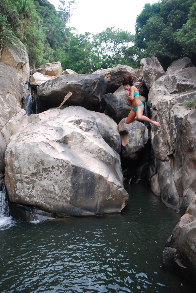
Ba Ho can be organized together with a boat tour to amongst others Suoi Hoa Lan waterfalls.

Above photo from internet is by jessia22 with the caption
'Nha Trang Ba Ho waterfall- Nadeane jumping'.

Wednesday, January 12, 2011

History lessons


Waterfalls are often described in superlatives. Beautiful, incredible, powerful, tremendous.
Or be for it's characteristics. Highest, widest, biggest.

Historic
It's not often that one would say that a waterfall is 'historic'. I've been racking my brains to find a 'historic' waterfall, but other than waterfalls which became history (now hydro-electric generating plants) or waterfalls in regions seeped in history (Schaffhausen) I don't believe that there is a waterfall that can lay claim to be at the foundation of a kingdom/empire.


And exactly that is what is claimed by the waterfall of the Phnom Kulen (or Ku Len, which translates to mountain of the lychee) mountains in Cambodia's Siem Reap province.
Wikipedia describes the historic event as
'it was at Phnom Kulen that King Jayavarma II proclaimed independence from Java in 802 A.D.'
Or in other words, here was were the Khmer nation (some say empire ...) was born.

Apparently it became the first place where a settlement was erected and only after a century was it decided to leave the mountains for the plains of Siem Reap to rule and eventually construct numerous temples and complexes, the most famous relic being Angkor Wat.

So you can imagine what belief this waterfall holds for current day Cambodians.

Lush
Phnom Kulen waterfall can be found in the mountains with the same name. Located about 50 km northeast of Siem Reap, one is surprised by the lush vegetation in what is arguably a very dry area; the mountains are also not very high, averaging just over 400m above sea level.


Getting here involves taking the road to Anlong Veng (from Siem Reap) or the older road to the temples of Banteay Srei. Just beyond Banteay Srei you hit the new road to Anlong Veng on a roundabout in the middle of nowhere which is about 500 m in diameter (seriously). One then takes the eastern most road and after 50m the tarmac stops and one is on a not so bad gravel road. Ten km's up this road, one comes to the gate, the entrance to Phnom Kulen National Park.

The upper fall

Until about a decade ago the waterfall required considerable effort to visit. Then came the idea to put in a road which was awarded to some military official, who now has the right to rule his fiefdom. This means he can charge $20 US per foreigner for the privilege of using his very difficult rough and tumble (but do-able) road up the mont. And absurdly pay another 3,000 Riel (0,75 $US) at the top as a parking fee; what that actually entails is a mystery as vehicles are parked haphazardly between trees. Oh well, that must be how the Cambodian empire started.

Crossroads
After paying the parking fee, one is at a crossroad. Here are three highlights. The waterfall is left, the reclining Buddha is straight ahead while the 1,000 linga's are also over the bridge then right.

We first head to the waterfall and park the car in some shade. Head towards some buildings. Here at the top of the waterfall are a great number of restaurants and rest huts. We are set upon by a group of ladies intent on selling us lunch, even though it's just 10 in the morning. We feign disinterest and head through the throng. First we see a minor waterfall to the right.

Beyond the tree lined lip lies the waterfall itself. We can walk down over wooden steps to the rocks below the 30m high waterfall. Once at the bottom of the waterfall one can scramble along the boulders to cool off under a large pool in the center. Along the sides below the falls, commercialism is still in force, bathing costumes can be purchased, changing rooms and the possibilities to dress up like a local Mondulkiri tribes person (see lead photo) and get one's picture taken are just some of the diversions created to part with one's cash.


The major falls

The waterfall, is very nice, but the rampant commercialism is just too much. Besides the use of every nook and cranny to set up a shop, trash seems to get dumped just beyond the visit site with lots (and I mean lots) of rubbish just drifting over the site. Trash ye historic site and be merri.
Added to the rubbish, shops and sellers is a surprising amount of Cambodia's doubtless masses of unemployed eagerly awaiting a tip for their nuisance of begging. Elsewhere others simply tag on to you like a leech and expect a fee for services rendered (guide?). Not my kind of place ...


Ruined
So, what's historic? Just on the other side of the upper part of the falls are original ruins.
The ruins go by the name of Prasat Krau Romneas, apparently dating back to the ninth century.

Not much has been done, or let's say nothing has been done to make this more appealing or, god forbid, protect it from the ravages of tourism. The entry fee only goes so far. Probably adds to someone being able to cruise Phnom Penh in their new Lexus.

Furthermore about 500 m away is the 400+ year old sleeping Buddha on top of a rocky point. More info on this Buddha from Andy Brouwer. A visit is a must if only for the view over the surrounding jungle.
At the foot of this temple is the site where one can rent a moto (and driver) to visit some of the mostly remoter sites on the mountain; a real treasure trove apparently for the more adventurous.
For instance: Shra Damrei and Peung Tbal.

Better still, wander down to the river, where the original occupants decided to elaborate the river. It's about 300m above the top fall. Over a stretch of 200m they have built linga's, the site known as 1,000 linga's.
Wikipedia:
'The site is known for its carvings representing fertility and its waters which hold special significance to Hindus. Just 5 cm under the water's surface over 1000 small carvings are etched into the sandstone riverbed. The waters are regarded as holy, given that Jayavarman II chose to bathe in the river, and had the river diverted so that the stone bed could be carved'.
The good entry in peaceofangkorweb laments:
'The 1000 Lingas pre date the ones at Kbal Spean, They are not so extensive or even protected from he feet of locals crossing the river'.
As well as observing the linga's one passes a meter deep spring which by the sight of the make-shift temples holds some current day religious significance. One must note though that as Khmer nowadays are Buddhists but back then they were Hindu's who traditionally hold springs in high esteem as forces of purification.

Just a couple of the thousands of linga's

Internet
As one can deduce protection of Kulen has yet to commence. The
Phnom Kulen Program hopes to better understand the significance of Kulen.


On the internet there is plenty of other info, visit records and photo's ... Most significant are besides the aforementioned blog entries by Andy Brouwer, his 1999 record of a visit here. Surprisingly not much (positives) has changed since then ....

Saturday, January 1, 2011

Delving Gems

With close to 100 entries on Southeast Asian waterfalls it's increasingly more difficult to be awed by yet another waterfall.
In general the bigger / higher waterfalls hold little value to me. Directly opposite are those that are relatively untouched, gentle and hold high natural and recreational value, often combined with some difficulties in reaching.


The Lao province of Xieng Khouang, one of this landlocked nations' major tourist destinations, is still a 10 hour plus drive from the capital of Lao, Vientiane. Mostly winding over mountain ridges with the odd descent and ascent of small vales, the bus brings one to the provincial capital of Phonsavan, not so far from a number of sites where we can admire ancient rites which resulted in constructing man-size jars.

Besides these Jars there is much army surplus to be awed by: the Vietnam war leaving behind landscape scars, ruined towns, destroyed lives and the potential to victimize still unborn locals for years to come.
The spectacular natural surroundings command little interest for tourism operators. The waterfalls (named Tad Ka (Tad Kha)) near Tajok village are an exception. But if these would stand for the province's natural beauty, more, much more should be available.


Located a little more than thirty kms to the northeast of Phonsavan, Tajok is easily reachable and typical of the many roadside villages which hug this road. Taking a right in the village, followed by another right 200m down the road one comes to a poor track which heads down the mountain side. Probably poorly accessible during the rainy season (witness Twoelders on travelpod), during the dry season one can continue downwards to a turn off with a large building.

Our guide states that this building accommodates holiday crowds which at the time (December 2010) seems a long shot. We're told to follow a trail uphill along a ridge which seems to contradict the fact that a waterfall is audible from the valley depths. The trail eventually drops steeply (200m?) to the river below. No waterfall, but a beautiful stream which is finding it's way through the picturesque forest. For the next 15 minutes we cross the rivulet often as we head upstream.


Eventually we come to a triple set of larger falls. Beyond the first fall is a nice deep swimming hole. From here we can walk steeply up the slope to the ridge track which ends at the building but from the other side.

A very beautiful waterfall, undisturbed and mostly unvisited. A gem. Unfortunately our memory card is playing up, so no photo's can be made. The following photo is from superstock.com:

'Waterfall in the forest near Phonsavan.
The waterfall is popular visiting the Phonsavan region in Laos'.


Wikitravel's description is as follows:
'The waterfall is located near Tajok village, 32 km north of Phonsavanh. The water flows over several tiers. A spectacular jungle trail winds its way up the waterfall crossing it several times. Tad Kha is a popular picnic spot for locals, especially during the Lao New Year holidays. To get there turn right at the end of Tajok village; follow the road until you see a building to the right. Walk along the ridge and take the right trail down. Local tour companies offer day tours including a picnic lunch and a hike up the waterfall'.

Outing to Kham district
A final departing pic from James Zwier:
'Outing to Kham district. One of the many waterfalls in a long series at Tad Kha'.

Thursday, December 23, 2010

Jarring

Tad Lang: the lowest and biggest drop

The Lao province of Xieng Khouang (Xieng Khuang) is not synonymously known for it's natural attractiveness. But rather for it's historical significance: most recently as the Vietnam War's location of dirty deeds when US aircraft saturated the area with bombs in a futile attempt to stem the communist Vietnamese from gaining the overhand in Vietnam. Simultaneously aiding their ally, the Hmong people, in their own attempt to avoid Lao from subsiding into communism.

More historically significant are the occurrence of man-size jar-like artifacts, hewn from stone and 2000 year beyond their birth; baffling researchers and tourists alike.
Neatly concentrated at a number of sites within Xieng Khouang province, these jars point to sophistical funeral rites.

Lots of jars

It's near one of the more picturesque sites where these jars can be found that one can visit Tad Lang (Tat Lang): a tumble of water, falling over the edge of the plain into the moist monsoonal forest.

Site 3 of the Plain of Jars is found in village of Xiengdi, due south of Phonsavan, the provincial capital. The ride here is a rough ride over unsurfaced roads slowly becoming less wide. Three km's before the jar site, one can head down a clearly indicated track towards the waterfall, which is about 1 km away from the turn off. Just before the waterfalls themselves is a small guardpost where a local villager will hand out entrance tickets in return for 10,000 kip (Dec. 2010 ~ US$ 1,20).


One continues to the top of the falls. The wide stretch of barren rocks stands as witness of the fury to be encountered in the rainy season, however now, a few months after the last rains, there is only a two meter water stream finding it's way down in a series of smaller falls to the base about 60m below the top.
The biggest fall is at the bottom about 15m. The top of the waterfall contains a number of pleasant pools, which are probably an attraction to locals, foreign tourists straying here seem very infrequent. On a week day the place is for one own though villagers still stride through the upper area on their way to their fields and/or forest. Lower down, the pools are not nearly as good but much more secluded for those preferring this.

Rocks made naked by high monsoonal waters

On your way south out of Phonsavan stop by the tourist information, there's more (and extensive) information to be had concerning the province as well as a load of junk, otherwise known as unexploded ordinance (UXO). Essential to exploring the province in more depth is the "A Guide to Xieng Khouang" by Creutz and Van Den Bergh, though all of the text is also on Wikitravel.
Other web based info from Virtualtourist, while on travelpod there is this conclusion by Zombywoof:
'... the waterfall was loud and impressive'.

Definitely not a waterfall fanatic.

There are also a couple of photo's by phnomsin on opera, which wraps up another waterfall entry.

Friday, December 17, 2010

Chambok revisited

Chambok has been visited in the past, see this posting. Not much has changed since, which if paying $3 you would think that some improvement had occurred in 4 years! But not.

Yesterday's visit with friends was a delight. Heavy overnight rain had replenished the surroundings and the water was crashing down. Some new signboards are up encouraging everyone to help in keeping the spot clean, though trash hadn't been collected in quite some time.

In Chambok itself the Romantic Waterfall Cafe (and mini guesthouse) has opened business run by the charming Puoh. Expect not too much, drinks are beer, wine, cokes and coffee. He did put in lot's of effort in his hastily arranged fried rice.

Related Posts with Thumbnails