Showing posts with label skinny dip. Show all posts

Sunday, April 29, 2018

Pretty

garethsayers on Koh Phangan
When in Thailand 🍑 #waterfall.........#thailand #holiday #travel #instatravel#waterfall #sunsoutbunsout#datass#datassthough #shower #outdoors#islandlife#thisassbelongstoAimee#idowhatiwant
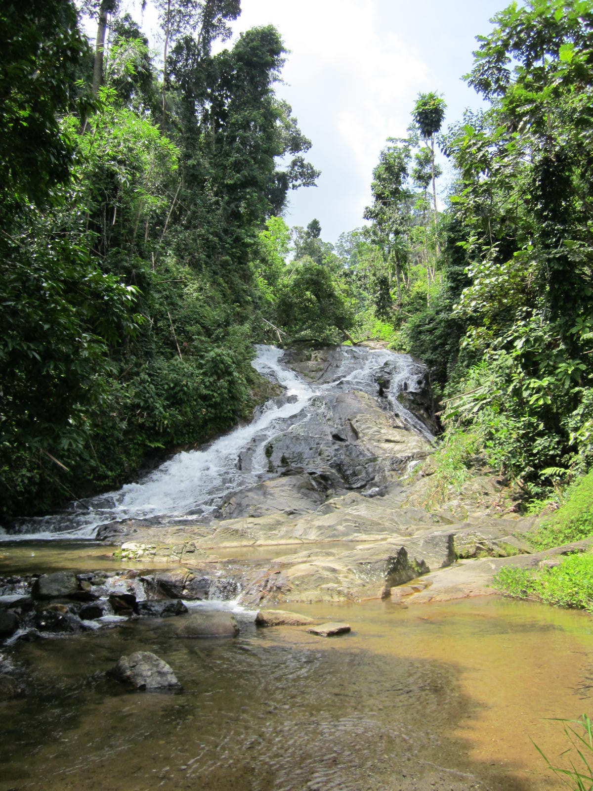
Ach ..., time for some waterfall photo's fresh from Southeast Asia's waters. Quite a collection, must becoming more normal. Question mark.

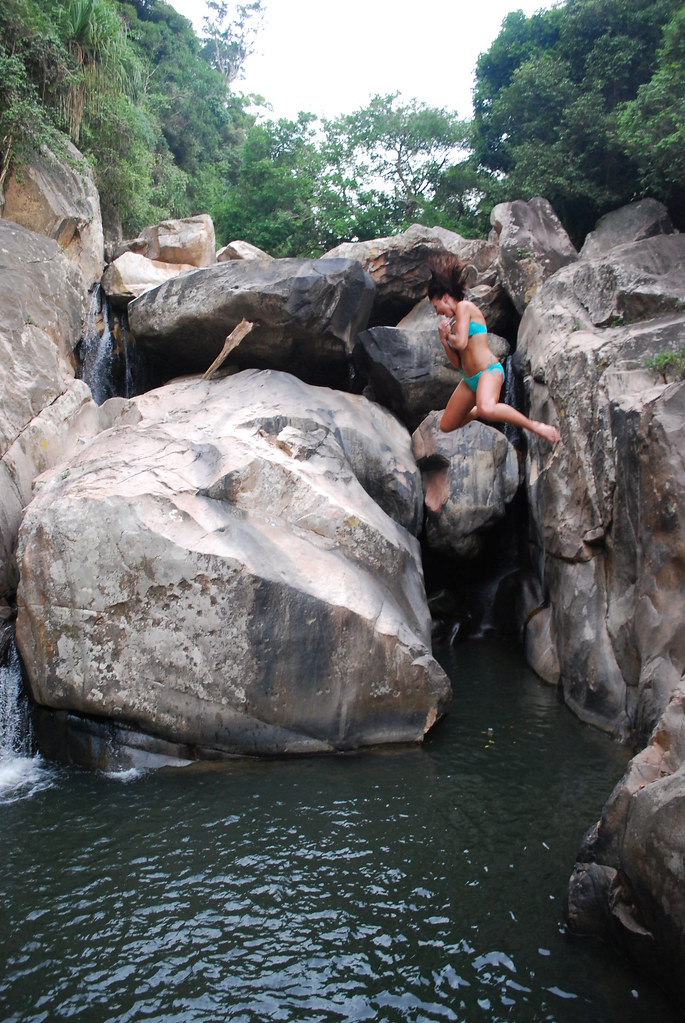
Above showers from south Thailand, followed by the skinny from the Philippines and a surprise from Vietnam.

A quick skinnydip#peri#wonderingbird #philippines #bohol#waterfall #pahangogtwinfalls #skinnydip#nature #beauty
Being naked in pretty places#vietnam #waterfall #skinnydipping
Pure

Enjoying mother earth's cold shower in a little nature spot we found on our adventure!! 😍


.

.


.

.

#nature#motherearth#waterfall#lush#green#asia#thailand#kohlanta
#adventure#happy#earth#jungle#girls#naked#birthdaysuit#purebliss#hippie #bohemianspirit#gypsysoul
Three sets of falls, from south Thailand (above) to northern Lao to Bali (following), it seems everyone is getting #bodypositive ...

Waterfall, nothing can harm me at all, My worries seem so very small With my waterfall. #nakedinloas #nudes#nakedadventures #nakedinnature #booty🍑#loveyourself
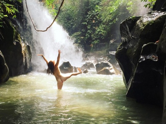
Freedom exists in learning to let go of learned body shaming and expectations 🙌ðŸŧfeeling uncomfortable with nudity is a reflection of feeling like our own bodies are something to be hidden or ashamed of. What if we just drop this whole body shaming towards ourselves? Imagine how much more beauty we could see in other people ✨Feat. my lovely friend Sierra#bodypositive #free
Calls
Nature is calling, and I must go.#natura #nature #naturaleza #grotta #grotte#cave #caves #cueva #cuevas#piscinanaturale #piscinenaturali#naturalpool #naturalpools #piscinanatural#piscinasnaturales #nudo #naked #desnudo#naturismo #naturism #corpo #body #cuerpo#vangvieng #vangvienglaos #laos #travellaos#travelasia #asia
Staring off with central Laos (above), if there's no waterfall there's still ample opportunity in other freshwater bodies. 
Following are pursuits of passion (Nong Khai no less, northeastern Thailand) and freedom (Phillipines).

'For this is what nature does; it sets fire to the soul, energizes, rejuvenates, teaches and elevates you.'#amazingthailand #waterfallwednesday#backpackerstory #worldnomads#womenwhoexplore #passionpassport#exploreasia #solotravel #teachabroad

Waterfalls 💚 #camiguin#camiguinisland #waterfall #fililife#greatmemories #freethenipple #nature#katibawasanfalls #stunning #greattrip#explorecamiguin #exploretheworld#explorethephilippines

Tuesday, May 1, 2012

Up the creek


Easily accessible from the most touristed stretch of the Khao Lak coast (Phang Nga, Thailand), it could be expected that Chong Fa would be nearly overrun or near ruined. However the opposite is true.

'Please do not entry to the waterfall'
The entrance gate (Chong Fa is part of the Lam Ru National Park) is half open or half close with a poster revealing that the park is somehow off-limits (photo above). A plus is that the park is (still?) open. Furthermore, no entry fees are required. And once again the access road is too difficult to take. There is a lone ranger, but he has his pitched his hammock up high and is wondering what his dreams will bring him.

From the entrance to the waterfall is a 1km long access road. From the road head it’s another 200m walk along a track to the first level, so no real strenuous hike, but a deliteful one nonetheless.


Getting there is a big part of the experience.
Chong Fa is a fabulous waterfall with lots of water crushing down into a deep and sunny pool. Downstream along the access road, are more swim holes, all deep and free flowing with great opportunities for a great dip.

It really is amazing, this piece of paradise so close to the paradise lost of Khao Lak.


There’s one website which has some more info on Khao Lak’s waterfalls (it mentions Chong Fa as having a steep (!) track to the first of five levels), but in general Khao Lak’s waterfalls are neglected and ignored, despite these being a great way to diversify the coast’s attractions, generate income and able to increase awareness of the globe’s natural surroundings, their fragility and the unique experience they offer. It contrasts with other places nearer Bangkok where waterfalls have become attraction parks, places of recreation.

But for me the tranquillity and (temporary?) absence of the great world is an opportunity to indulge in swimming, plunging and receiving a natural back massage.
Chong Fa, back massage please!

Thursday, November 3, 2011

Plunge jacuzzi

View from the old road

Ease of access is key to most Thai waterfalls, but seldom is access so guaranteed as to Punyaban (or NamTok SetTakuat, source) which falls nearly onto highway 4, just north of Ranong town.

In the sharp U shaped turn, the old bridge and both banks are used to create a park like area with the 50 m waterfall as natural backdrop. Near the parking areas are two small restaurants as well as amenities block (or two). One can walk below to the stream level and safely go up to the base of the waterfall.


Strongly recommended is to take the nature trail path on the north side. Steep, it’s well laid, though not often utilized. The educative element has slightly became a victim of time, the trail itself climbs beyond the lip to a smaller fall and beyond this to a 10 m fall.

View towards Myanmar

With a beautiful view as well as the solitude gained so close to the mad world as represented by a major highway, this area above the larger waterfall entices one to become one with nature and plunge in the natural rock jacuzzi’s or get immersed under the falls them selves.

Up beyond the main waterfall are some great skinny dip pools.

More info can be obtained from cathy and gary's travel page entry on Punyaban. Note that the waterfall i s just 10 minutes drive north of Ranong town, it counts 3 levels but only 20m height. Their end note:
'Punyaban Waterfall - Beautiful Place'
Others mention the nature trail heads back down on the other side.

Lonely Planet rates Punyaban as no. 5 of the 11 things to do in Ranong.

Interestingly the blog waterfallsonstamps names Punyaban as one of his 9 stamps of waterfalls from Thailand (from 1980, 2 THB!).

Anyway, Punyaban is definitely a contender for top 10 waterfall position in Thailand.

Just one of the pools waiting for you to quit your sweaty clothes!

Friday, September 2, 2011

Of mannequins and monks


Sometimes you come across a waterfall with a difference. Huai Yang waterfall has something different. Namesake for the surrounding National Park (meaning the requirement for a 100 THB entry fee ...), it's obvious it sees huge numbers of visitors, based on the well paved car park. 

Despite this being a weekday, a few cars are pulled in and on the opposite side of the creek is a huge huddle of white clad students acting as if they are listening solemnly to some speech or another.

Unfortunately, just when we hit the track so does the group and swamped by white shirts (which political direction do they support?) we climb up the track. It's a nice climb, once in front of the group.


Keeping ahead and looking behind: level 3.

Up on the ridge one gets to a small shrine. Beyond is a big pond at the foot of a slender fall, the third level of five. Possibly already wearied down tourists are hanging around. But there are more levels to explore. One can jump over rocks to the other side, followed by a scramble over bare rocks. The stream equally forces it's way down over mostly short scrambles. We reach the next level, a delicious pool with a great 15 m fall on the opposite end.

Oddly enough a monk is here, feeding the fish (see lead photo, above), mostly catfish and carpers, largely ornamental varieties. It's a disturbing trend in the maintenance of what are essentially national parks, rearing fish, so as enhance something or another. The more frequented waterfalls of Thailand (read Erawan, Pa La U) seem to be teeming with fish and considering the regular feed supply, it's no wonder.

My son vehemently opposes any swimming with any fish, while my wife decides that it's not her day. I wait for the monk to totter off, undress (that's me) and enjoy another spectacular part of Thailand's nature. Meanwhile  praying the fish won't nibble my special parts ...

Alex has a number of photo's, but other than that there is not much than the obvious reference on how to get here: located in Prachuap Khiri Khan province, the waterfall is conveniently accessible from the major highway south (km 350), only a 7 km ride to the foot of the mountains.  

There's panaramio.  

And travelfish.

Ursula's weekly wanderings has an interesting entry on the spirits of Prachuap Khiri Khan including some photo's which really are weird kind of spirits (mannequins?) which are to be found near the shrine at the first level.

Sunday, August 7, 2011

Stacks


The lowest level seen from above

The details:
'This waterfall is located at km. 556-557 on highway No. 4 3 kms. from Kra Buri township with another 13 kms. on the leftside of the main road along the laterite road to the fall. Bokkrai Waterfall has many steps with fascinating nature surrounding'. source

Bokkrai, Bok Krai or Bok Kray. Sounds and looks pretty clear and this time around, it is clear. The road makes it all the way to Thungraya - Nasak wildlife sanctuary's entrance, another protected area along the spine of Thailand, straggling Burma or the Andaman coast. After we pay the 100 THB entrance fee (~$3) and receive a stack of tickets in exchange (good deal, 30 tickets of 10 THB instead of just the normal 3 of 100 THB), we proceed to the deserted car park just beyond the entrance.

Ranong's landscape is nice and lush, the minor road up to the sanctuary entrance winds it's way through mostly rubber plantations with the odd oil palm plantation thrown in for reasons of variation.


>Anyway once in the sanctuary, the bush is still lush but more lustrous. Quite wet, a good track goes to the namesake waterfall, only 200m away.

Bok Krai, the main lower level.

There one learns that there are more levels, 7 no less and we take the good looking track up. However the higher one climbs the more muddy and less maintained the track becomes, like having to fight oneself through a jungle.

But, what a beautiful place. Well deserted with some the gracious pools. I hate to disturb the free flowing nature with my own natural antics but why else come all the way from the modern world if not to merge with the natura?


Sorry for the disturbance!

Elsewhere on the net are another blog entrance as well as some more photo's by nobythai.

Sunday, July 10, 2011

Deadly

Khao Sok National Park is a funny kind of place. Due to it's relative proximity to Phuket / Khao Lak, the ability to use it as a stopover from these places to / from Samui ferry and being just one km from a nice highway, it see's it's fair share of tourists. So much so, that a village of lodges, minimarts, travel agencies and cafe's / restaurants has sprung up.

Besides the facts of access, the reasons for a visit include the entrance point to one of Thailand's biggest and most spectacular national parks, the impressive craggy scenery and deliteful meandering stream that finds it's way through the various bungalow operations.
A poorly translated blog site names Khao Sok as no. 2 in Thailands list of top 10 national parks.

An acquaintance with the steamy jungle is on the cards.
Khao Sok offers a number of trails, along some streams. Having done these trails already 20 years back, one would expect some improvement. But none of that. Though the village has expanded exponentially, the national park has little to show for 20 years of high entrance paying tourists. One is still leant on to take a guide to destinations just beyond a ninety minute walk over a 4WD track. Going beyond is forbidden without a guide, at least in the wetter half of the year. Such is the pressure that even to this point of return groups of tourists see themselves compelled to hire a guide which is ridiculous.

Though I might see some safety element in this, it questions why the same practice does not take place elders. Or why simply the trails are made safe enough for independent tourists. But maybe keeping the guide trade in business trumps all other reasons.


Anyway, mid 2011, we took the walk up the Khlong Sok as far as possible which leads to amongst a couple of swimming holes, the waterfall of Wang Hin. Wang Hin sits on a small tributary on the opposite bank of the main Khlong.

Beyond the Khlong, Wang Hin waterfall.

Further upstream are the waterfalls of Bang Leiap Nam and Ton Kloi, as well as Than Sawan which is up a side stream. Possibly a guide might be required for this waterfall

From the national park headquarters there is also the possibility to visit Sip-et-Chan waterfall, an eleven tiered waterfall (the translation already says it all). Possibly reachable during the dry season.

Other trekking destinations are the already aforementioned swimming hole
(see photo of Bang Hua Raet below) as well as a few more spots for a dip.

Me, getting more wet with water than the customary sweat.

Just outside the national park there is the possibility for tubing (with guide), canoeing (with guide) or elephant trekking.

Over the mountains is the exceptional experience of where a major stream in the park has been flooded for hydropower usage. The lake level has risen enabling boot journeys around and among the towering limestone cliffs, a must-see.

The lake on a rainy monsoonal morning.

Wang Hin waterfall of Khao Sok National Park is located in Surat Thani province, just over 100 km due west along the main 401 highway. Good and recent info on the park is available from Khaosok.com as well as from Khaosokdiscovery.com.

Probably some of the best independent users information comes from Tezza's beaches and islands extensive and updated entry on Khao Sok. He goes to considerable lengths to warn against leeches, I had only the one after 3 hours, which dropped off by itself and the bleeding terminated after a couple of hours.

The leeches contribute to Khao Sok being rated as the one of the
World's Deadliest Places to Swim!
'Before you go camping in this national park, be advised. The area is the home to more deadly creatures than any naive tourist can imagine. Huge centipedes the size of an adult man’s arm, man eating sharks[!, there are none!], blood sucking leeches, giant mosquitoes and poisonous caterpillars and Scorpion fish. Getting bitten by leeches is seemingly unavoidable so make sure to take up smoking as leeches hate tobacco. When attacked, mix water with tobacco and pour it over the leech and it should let go. Whatever you do, do not try and remove it by force as it will cause it to release its venom'.
A better perspective to be had is from Thom Henley's Waterfalls and Gibbon Calls (2005).

Monday, May 9, 2011

Cement


Saraburi is to most who pass through this province, synonymous with traffic, cement factories and huge Bhuddha's; certainly not with nature.

But surprise, surprise, Saraburi province, despite it's size, contains no less than 2 national parks,
Namtok Chet Sao Noi and Phra Phutthachai (sometimes known as Khao Sam Lan). Furthermore there are quite a few waterfalls, some more well known than others. Muak Lek waterfall (tiny), Heo Noi, Sap Heo, Suan Maduea, Sap Pa Wan, Krok Fa Phanang and Khao Khaep.

Dried up
As Khao Sam Lan National Park is listed as having a signature waterfall (Sam Lan) as well as some others (Pho Hin Dat, Ton Rak Sai, Krok I-woe, Nang Chon, Phaeng Ma and Roi Kueak Ma) and it's just outside town towards Bangkok (take road 3042, followed by 3046), it was the destination of the late April day.

Fancy coming up to the entrance and being told that the waterfall was dry. They basically implied that the 200 THB (~$US 6) special entrance fee for foreigners was not worth the sights located further up the road.
Many locals continued but it was said that they were going for the food stalls and to relax, as they don't seem to have to pay an entrance fee.


Oh well better this way than the other way around. Expect much more water later on in the year.

[Update: The Bangkok Post (1 September 2011) places an article on the Sam Lan NP suggesting it is better to negotiate the park by cycle:
'Being the Kingdom’s smallest national park, Namtok Sam Lan NP of Sara Buri province covers an area of only 44.5 square kilometres. It is named after a waterfall that is known to be dry and lifeless most of the year, except on days that it rains real, real hard'.
Hmm ...

Next stop
I took a long and hard look at the map and decided that Chet Khot (Chetkhot, Jedkot?) waterfall would be do-able, not too far away. I double checked at the national park entrance and they said, yes, expect more water there. Fine.


So eventually back on route 2, in the plethora of traffic. Past cement factories heading to the giant Bhuddha. Ideally you want to turn off in Thap Kwang village, just before the highway starts to rise into the hills. But hey, this is an 8 lane highway, don't do the U-turn, just travel up beyond the next cement factory and there there is a fine overhead U-turn, safety wise better and loads more comfortable than sweating it out while waiting for a break in traffic.

Back in Thap Kwang head left and ask around. Eventually you'll end up on the right road which goes up into the hills for another 10 km or so. Winding itself around and over the hills it passes some smaller villages with small plantations. Signage is clear from here.

Surprisingly despite it's proximity to Bangkok there's little touristic development. Eventually the road ends at a car park, a couple of other cars and about 20 or so motorcycles, no entrance fee is required.


Upstream
There are a couple of buildings around the car park, overlooking a series a small rapids.

On the other side of the stream, a track disappears into the forest. It's a 1,5 km track which traverses the stream about halfway. At the end is brilliant pool with about a 10m high waterfall.

Young lads (owners of the motorcycles) are jumping off the cliff and generally seeking some kind of attention. A beautiful spot, but even on a Tuesday too spoilt by my fellow humans.


I walk up the side of the cliff, our youngsters expecting me to jump as well, but no (thank you), I just continue up the stream. There's no path but wading through the stream and scrambling over the rocks, brings more sought-after solitude, another beautiful spot.

Around
I hope it stays like this, my map also has a dotted red line crossing closeby the falls, the motorway no. 6 project. Yikes!


There is surprising amounts of info available on Chet Khot especially as somewhere nearby there's a nature study center (or here) located which arranges treks to more waterfalls in the area; Chet Khot Nue, Chet Khot Klang, Chet Khot Tai, Chet Khot Yai, Khao Raet (or Khao Khaep?), Krop Fa Phanang and Krok I Dok.
Andy has stayed overnite. Wow.

There's an article from the Bangkok Post (September 2006) about a visit here, including his or her experiences while trekking to Krok E-Dok waterfall, 8-10 kms from the center, but surprisingly under two hours of walk!

Kitaro has a photo overview of Klong Pakkham in Chet Khot forest.

Well, now I know Bangkokians have no reason not to escape town ...

Monday, May 2, 2011

Horn-billing


Phetchabun province is just over 4 hours easy drive from Bangkok, but it's a great place to visit which (despite it's proximity) still receives next to no tourist; even Lonely Planet doesn't mention this beautiful province!

In essence, Phetchabun province is a wide north-south valley, crammed between at first hills, later on 1000+ m, so no wonder that waterfalls are a major feature, though surprisingly scarcely visited.

One of the lesser known national parks in Phetchabun is that of Tat Mok, considering that the province also contains the Hin Rong Kla national park. The 290 square km Tat Mok National Park is named after it's signature waterfall which is said to be a 1-level 200-300m high waterfall

Getting here is not too difficult, from Phetchabun town head southeast and take road no. 2271 until it reaches road 2275. A right turn is required and then quite quickly the entrance to the park will need a left turn. From the entrance it is 18 km over a mountainous road to the road head.

Not many foreigners make it this far up-country and after the ticket lady contains her surprise thereafter followed a frantic scram (involving 4 staff members) to find the correct 200B entrance tickets, nearly 7 $US (April 2011).


It takes about half an hour to drive the deserted road to it's ultimate destination. Going up there are two larger viewpoints, if clear one could easily see Phetchabun town. After the first hill there are some more offices and a campground, beyond seems to receive even less visitors. At a certain moment I need to get out and remove a large branch from the otherwise good road. The valley gets more narrower and ends at a small car park with some amenities, but no one seems to be hanging around on a late Monday afternoon.

The track then starts and should last for nearly 3 km, 45 minutes. It's not often that in Thailand there are long walks possible (Thai's prefer drive-in nature) and certainly not well signposted ones. The trail hugs either side of the stream and has seen better times. On narrower sections, the improved pathway has been washed away as do all bridges. Attempts have been made to keep the track passable and it really is a nice beautiful walk.

An improvised bridge

Finally one comes to a section where the trail splits, the lower path continues onward for another 200m to the Song Nang waterfall (or Songnang)whereas the higher steps should take you to Tat Mok.

As rain is threatening with clear intentions of today's daylight being curtailed, I skip the Tat Mok part, as it is a high waterfall but with little water.

Instead the Song Nang waterfall is in front of me. It's a 10 level waterfall with delicious pools to skin dip in, yeah!


Author chillin

After chilling out it's time to return, drops of rain are falling. The best part of this is that birdlife are welcoming the moist and are out in numbers, audible though not visible. A salvo of larger cries leads me to believe that horn-bills are overhead and low and behold at an opening I see no less than 10 juveniles frolicking in the tree tops.

Back at the end of the road, there is still a great place to rinse off the return sweat before returning to civilization.


There are a couple of web sites on Tat Mok, mostly poorly translated from Thai, resulting in a load of gibberish, see for instance
'Tat Mok - two waterfalls her'.
sbayura.com has a good posting on Tat Mok / Song Nang including extensive photo's.
Thaiways has a picture of level 6.

Nearby is the hot spring of Nam Rong, possible as a post walk soak.

Monday, April 4, 2011

Past the bear pit


Part of the Yang Bay Tourist Park complex or at least just outside the most developed part of this tourist development complex, Ho Cho waterfall is a wide low waterfall, in all descending 6-8 m. I guess. Below is a great pool where one can take a very undisturbed swim. At least during the week, when visitors are few and far between.

That's for now. It's quite strange, this lack of even a decent track, slam-bam next to Yang Bay Tourist Park. Instead of going to Yang Bay waterfall itself, once inside the 'park' one takes the left road past the bear pit, tribal game place and orchid garden. Abruptly the wide road stops (10 minutes after taking the road) at a wild stream.

A small path continues through the high grass to the river where a small log has been laid over the first 2 m of the river crossing; the rest can be achieved by jumping from rock to rock. On the other bank of the river, the track continues through the forest until it hits the rock-face of the waterfall itself. No track beyond this by the look of it. Time for a dip.


The Yang Bay Tourist Park companies brochure describes Ho Cho as follows:
‘To be deep in the forest. Ho-Cho waterfall is considered as a challenge to visitors. Ho-Cho waterfall also owns a lot of hot mineral water sources helpful for cure’.
Well, the effort required can not be described as a challenge, it is pretty easy. I'm unsure about the hot spring claim though, it certainly was not apparent.

Another link to the possibility of there being mineral water is here:
'After a refreshing dip, visitors can relax in a natural hot spring'.
As stated in the Waterfalls of Southeast Asia blog entry on Yang Bay, management may want to expand the mineral water on offer and add in some mud (as in the success of Thap Ba hot spring).

It's a pity that not much is made of the current mineral water facilities, if existing.

Despite the development, Yang bay and certainly Ho Cho are worth the effort.

Update [June 2012]
This article mentions 
'The waterfall [Ho Cho] includes two streams, one hot and one cold. If tourists fancy having fun in the hot water or just want to relax, the park management board has built a swimming pool, which mixes the two streams of hot and cold water.
The waterfall will soon be developed into a hot spring site'.
All part of an expansion ...

Saturday, March 5, 2011

Intoxicating?


Suoi Ba Ho translates as "Three Pools Stream", which seems to give more credence to the waterholes beneath the three falls. In quick succession these falls find their way down about 100m of granite, hollowing out their lakes and creating a number of great swimming holes.

Unfortunately access is not fantastic. The turnoff from Vietnam's Highway 1 is 20-22 kms north of Nha Trang, the Khanh Hoa provincial capital, located on the south central coast. There’s a larger sign just before the small surfaced road. Three kilometers it says, which implies possibly 3 kms until a T-crossing with no sign there but where one needs to take a left. Continue onwards for about another 3 kms over a poor rough and tumble road, one eventually ends at a car park, in the process of being built into a bungalow park.

Well-shaded by tall trees, the rudimentary car park is along a sluggishly moving stream. On the opposite side are also bungalows being built, certainly marks of forward planning. Vietnamese ecotourism. The best part is that this is the worst part of whatever this development entity calls itself.
A quick payment of 20,000 VND (a fraction less than a US $) had ensured entrance but the destination was still a little upstream.

A wide track continues along the stream until it shortcuts a turn and hits the boulder strewn stream itself. From here to the first fall one needs to jump from rock to rock. One gets to the first lake (and fall) after about 45 minutes from the car park.


Surprisingly for a Tuesday mid March, there are two large groups of locals at the lower lake having a merry time, slowly getting intoxicated.

Did I tell you that the National Parks of Thailand want to ban alcohol consumption in their jurisdiction? According to the Nation (December 28 2010) On the one hand, that leaves us folks who can control our intake with empty hands, on the other hand, drunks playing the clown are a part of the past.

Anyway, there’s a track up the side of the canyon, a very steep track. Fifteen minutes up and it’s a steep slide back down. There is also the possibility to use metal rungs drilled into the rockside to pull oneself up to the next features. Up here there’s nobody to be found, a great place to dip the skinny, a personal first for me in Vietnam.


More info from internet are the pages on Ba Ho Falls:
'Therapeutic properties are attributed to the waters of the three pools at Ba Ho Falls'.
Asian waytravel:
'Ba Ho is primitive with its tortuous soil paths, grass covers and green trees drooping down to the rock bedded streams. The romance of nature makes travelers forget daily worries. The interesting thing at Ba Ho is that tourists can step over the rocks to get to the banks. The place is perfect for a picnic. Under the glistening sunlight, tourist can relax in the cool water.

For young people, relaxing in the water is not enough. With a stick and slow careful steps up the path heading to the peak, tourists can take a panorama of the three lakes. In the immense streams, tourists can swim to feel the pure, clear water'.
Ba Ho can be organized together with a boat tour to amongst others Suoi Hoa Lan waterfalls.

Above photo from internet is by jessia22 with the caption
'Nha Trang Ba Ho waterfall- Nadeane jumping'.

Saturday, January 1, 2011

Delving Gems

With close to 100 entries on Southeast Asian waterfalls it's increasingly more difficult to be awed by yet another waterfall.
In general the bigger / higher waterfalls hold little value to me. Directly opposite are those that are relatively untouched, gentle and hold high natural and recreational value, often combined with some difficulties in reaching.


The Lao province of Xieng Khouang, one of this landlocked nations' major tourist destinations, is still a 10 hour plus drive from the capital of Lao, Vientiane. Mostly winding over mountain ridges with the odd descent and ascent of small vales, the bus brings one to the provincial capital of Phonsavan, not so far from a number of sites where we can admire ancient rites which resulted in constructing man-size jars.

Besides these Jars there is much army surplus to be awed by: the Vietnam war leaving behind landscape scars, ruined towns, destroyed lives and the potential to victimize still unborn locals for years to come.
The spectacular natural surroundings command little interest for tourism operators. The waterfalls (named Tad Ka (Tad Kha)) near Tajok village are an exception. But if these would stand for the province's natural beauty, more, much more should be available.


Located a little more than thirty kms to the northeast of Phonsavan, Tajok is easily reachable and typical of the many roadside villages which hug this road. Taking a right in the village, followed by another right 200m down the road one comes to a poor track which heads down the mountain side. Probably poorly accessible during the rainy season (witness Twoelders on travelpod), during the dry season one can continue downwards to a turn off with a large building.

Our guide states that this building accommodates holiday crowds which at the time (December 2010) seems a long shot. We're told to follow a trail uphill along a ridge which seems to contradict the fact that a waterfall is audible from the valley depths. The trail eventually drops steeply (200m?) to the river below. No waterfall, but a beautiful stream which is finding it's way through the picturesque forest. For the next 15 minutes we cross the rivulet often as we head upstream.


Eventually we come to a triple set of larger falls. Beyond the first fall is a nice deep swimming hole. From here we can walk steeply up the slope to the ridge track which ends at the building but from the other side.

A very beautiful waterfall, undisturbed and mostly unvisited. A gem. Unfortunately our memory card is playing up, so no photo's can be made. The following photo is from superstock.com:

'Waterfall in the forest near Phonsavan.
The waterfall is popular visiting the Phonsavan region in Laos'.


Wikitravel's description is as follows:
'The waterfall is located near Tajok village, 32 km north of Phonsavanh. The water flows over several tiers. A spectacular jungle trail winds its way up the waterfall crossing it several times. Tad Kha is a popular picnic spot for locals, especially during the Lao New Year holidays. To get there turn right at the end of Tajok village; follow the road until you see a building to the right. Walk along the ridge and take the right trail down. Local tour companies offer day tours including a picnic lunch and a hike up the waterfall'.

Outing to Kham district
A final departing pic from James Zwier:
'Outing to Kham district. One of the many waterfalls in a long series at Tad Kha'.

Wednesday, October 13, 2010

Couple of waterfalls

Lan Sang waterfall.

Located nearer Tak town than Taksin Maharat National Park (see also entry on Pang Ah Noi waterfall) is the national park of Lan Sang (sometimes written as Lansang). Just 17 kms along a gradually climbing towards the foot of the mountains road in the direction of Mae Sot (Highway 105).

As always there's a significant entry fee (~$US 7), but with the added benefit that the aforementioned Taksin N.P. is included in the same price if visited the same day.

Once past paying the road continues onwards along the Lan Sang stream for another km until one reaches a carpark. By then one could have already visited the Lan Lieng waterfall.
At the carpark there is also an information kiosk and after some search a toilet, oddly that they built two toilet structures next to each other.


A short amble gets you to Lan Sang waterfall itself. The waterfall is a small series of 5-10m drops between a rocky gully. Some good pools for splashing but as this is easily accessible it might be a little too public for my (and wife's) exhibitionist behavior. Or so it maybe construed. Careful.

Instead we notice the nearby signboard which mentions a number of waterfalls along the same riverulet but more upstream. All seem within an hours walk (the furthest, Pa Tay (Pha Te) is only a little more than 2 km away) and my wife and I decide to tackle the track to the next fall. The track alongside the stream is narrow and beginning to be overgrown. About 30 minutes up is Pa Pueng, the destination. This fall is much more open and is actually the stream going along a 20m slope rather than a real fall. Nonetheless a great place to hang out naked.

Pa Pueng waterfall during rainy season (October 2010).

On our way back we discover a much more worn track which though longer takes just the same amount of time. Once back we discovered we were just a short distance from the next waterfall Pa Noi.

More photo's of Lan Sang here and here.

This website provides a good insight:
'Legend has it that while leading an attack on Chiang Mai, King Krung Thon Buri became separated from his troops. In the dark forests, his soldiers were forced to wait for daylight to search for their beloved King. ' That night, a strange light appeared in the sky and the soldiers heard the King's horse whinny in the distance. They followed the horse's cries until dawn, when they came across their King mounted on his trusty steed. This site was aptly named "Lan Sang", the "Dawning Ground"'.

Friday, January 8, 2010

Cascade of Falls


Cambodia is not really well known for it's waterfalls and when it does, these seem to be all located east wards in the mountainous area near the Vietnamese border.

However those familiar with the Bokor mountains will have to admit that a mountain range located close to the coast is bound to have a waterfall or two. Which is the case though they are mostly unknown. The Kampot Survival Guide mentions a number of unnamed waterfalls which flow mostly during the monsoon which usually lasts a little longer here. Known to locals but with little details for tourists.


Prek Thnaut is one of these lesser known waterfalls or better said a cascade of smaller falls located not far from the road to Sihanoukville, roughly 25 km from Kampot. From the road one needs to pay attention to a school, on the north side of the road. Follow the dirt road to and around this school and one comes to Prek Thnaut visitor center, though as mostly visitors are expected during the monsoon and in the weekend, the center will mostly be deserted. Then again Save Cambodia's Wildlife, a nationally operating NGO is trying to promote community based ecotourism here so the center may not always be deserted. More info from Cambodia's Community Based Ecotourism Network.

Park the car here and continue on foot for another 200 m and you'll see various tracks diverging from the main track to different pools / falls.
The falls are mostly of 1 m height with small tubs beneath each.

Our visit here was in late December 2009. Water was still flowing and the pools were still refreshing though one can imagine that in April / May nothing would be flowing ... Then again come in September and you'will be swept away (literally?).

Tip: Take a bike from Kampot, the road is less traveled. Stay closer at the Nataya.

Update (August 2010): the Cambodian NGO, Save Cambodia's Wildlife, is stopping assistance here due to lack of donor funding. They have however published a brochure which is distributed throughout Kampot.

Related Posts with Thumbnails