Showing posts with label skinny dipping. Show all posts

Sunday, April 29, 2018

Pretty

garethsayers on Koh Phangan
When in Thailand 🍑 #waterfall.........#thailand #holiday #travel #instatravel#waterfall #sunsoutbunsout#datass#datassthough #shower #outdoors#islandlife#thisassbelongstoAimee#idowhatiwant
Ach ..., time for some waterfall photo's fresh from Southeast Asia's waters. Quite a collection, must becoming more normal. Question mark.

Above showers from south Thailand, followed by the skinny from the Philippines and a surprise from Vietnam.

A quick skinnydip#peri#wonderingbird #philippines #bohol#waterfall #pahangogtwinfalls #skinnydip#nature #beauty
Being naked in pretty places#vietnam #waterfall #skinnydipping
Pure

Enjoying mother earth's cold shower in a little nature spot we found on our adventure!! 😍


.

.


.

.

#nature#motherearth#waterfall#lush#green#asia#thailand#kohlanta
#adventure#happy#earth#jungle#girls#naked#birthdaysuit#purebliss#hippie #bohemianspirit#gypsysoul
Three sets of falls, from south Thailand (above) to northern Lao to Bali (following), it seems everyone is getting #bodypositive ...

Waterfall, nothing can harm me at all, My worries seem so very small With my waterfall. #nakedinloas #nudes#nakedadventures #nakedinnature #booty🍑#loveyourself
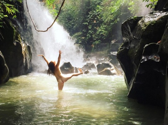
Freedom exists in learning to let go of learned body shaming and expectations 🙌ðŸŧfeeling uncomfortable with nudity is a reflection of feeling like our own bodies are something to be hidden or ashamed of. What if we just drop this whole body shaming towards ourselves? Imagine how much more beauty we could see in other people ✨Feat. my lovely friend Sierra#bodypositive #free
Calls
Nature is calling, and I must go.#natura #nature #naturaleza #grotta #grotte#cave #caves #cueva #cuevas#piscinanaturale #piscinenaturali#naturalpool #naturalpools #piscinanatural#piscinasnaturales #nudo #naked #desnudo#naturismo #naturism #corpo #body #cuerpo#vangvieng #vangvienglaos #laos #travellaos#travelasia #asia
Staring off with central Laos (above), if there's no waterfall there's still ample opportunity in other freshwater bodies. 
Following are pursuits of passion (Nong Khai no less, northeastern Thailand) and freedom (Phillipines).

'For this is what nature does; it sets fire to the soul, energizes, rejuvenates, teaches and elevates you.'#amazingthailand #waterfallwednesday#backpackerstory #worldnomads#womenwhoexplore #passionpassport#exploreasia #solotravel #teachabroad

Waterfalls 💚 #camiguin#camiguinisland #waterfall #fililife#greatmemories #freethenipple #nature#katibawasanfalls #stunning #greattrip#explorecamiguin #exploretheworld#explorethephilippines

Saturday, January 7, 2012

Massage please

Don't enlarge this picture!

About 10 km south of Suk Samran, on Thailands Highway 4 between Ranong and Takua Pa, just north of a bridge, an attentive passer-by will see a wearied and worried signboard, pointing inland, inwards to Suan Mai waterfall, part of Sri Phang Nga National Park, home to many new and unknown waterfalls.
The small road first passes some kampong houses, crosses a bridge and slowly climbs up through rubber and palm oil plantations, interspersed with some durian orchards, ripe for the picking.
The road deteriorates, then improves. After deteriorating again, one needs to continue going straight in a sharp left hand corner.
The road gets steep and enters a protected environment with what was once a parking area before a steep hairpin to an office with some tired looking government staff.

After stepping out of the car, one hears the rushing stream. Following a wide track and then a smaller track along a waterpipe, the 10 minute ‘trek’ ends at the foot of a nice 20 m high waterfall, Suan Mai.

Beneath the fall is a great pool to cool off and swim up for a natural back massage. Another nice find.


The surroundings are still very natural and pristine, despite the relative accessibility of these falls from the highway.


Interesting background knowledge is the website of the Andaman coast community tourism. It highlights some lesser well known waterfalls near Kuraburi. Other than this mention there is not much other information on the internet, it's very far away from anything remotely touristic, but as said a great find.

Monday, May 2, 2011

Horn-billing


Phetchabun province is just over 4 hours easy drive from Bangkok, but it's a great place to visit which (despite it's proximity) still receives next to no tourist; even Lonely Planet doesn't mention this beautiful province!

In essence, Phetchabun province is a wide north-south valley, crammed between at first hills, later on 1000+ m, so no wonder that waterfalls are a major feature, though surprisingly scarcely visited.

One of the lesser known national parks in Phetchabun is that of Tat Mok, considering that the province also contains the Hin Rong Kla national park. The 290 square km Tat Mok National Park is named after it's signature waterfall which is said to be a 1-level 200-300m high waterfall

Getting here is not too difficult, from Phetchabun town head southeast and take road no. 2271 until it reaches road 2275. A right turn is required and then quite quickly the entrance to the park will need a left turn. From the entrance it is 18 km over a mountainous road to the road head.

Not many foreigners make it this far up-country and after the ticket lady contains her surprise thereafter followed a frantic scram (involving 4 staff members) to find the correct 200B entrance tickets, nearly 7 $US (April 2011).


It takes about half an hour to drive the deserted road to it's ultimate destination. Going up there are two larger viewpoints, if clear one could easily see Phetchabun town. After the first hill there are some more offices and a campground, beyond seems to receive even less visitors. At a certain moment I need to get out and remove a large branch from the otherwise good road. The valley gets more narrower and ends at a small car park with some amenities, but no one seems to be hanging around on a late Monday afternoon.

The track then starts and should last for nearly 3 km, 45 minutes. It's not often that in Thailand there are long walks possible (Thai's prefer drive-in nature) and certainly not well signposted ones. The trail hugs either side of the stream and has seen better times. On narrower sections, the improved pathway has been washed away as do all bridges. Attempts have been made to keep the track passable and it really is a nice beautiful walk.

An improvised bridge

Finally one comes to a section where the trail splits, the lower path continues onward for another 200m to the Song Nang waterfall (or Songnang)whereas the higher steps should take you to Tat Mok.

As rain is threatening with clear intentions of today's daylight being curtailed, I skip the Tat Mok part, as it is a high waterfall but with little water.

Instead the Song Nang waterfall is in front of me. It's a 10 level waterfall with delicious pools to skin dip in, yeah!


Author chillin

After chilling out it's time to return, drops of rain are falling. The best part of this is that birdlife are welcoming the moist and are out in numbers, audible though not visible. A salvo of larger cries leads me to believe that horn-bills are overhead and low and behold at an opening I see no less than 10 juveniles frolicking in the tree tops.

Back at the end of the road, there is still a great place to rinse off the return sweat before returning to civilization.


There are a couple of web sites on Tat Mok, mostly poorly translated from Thai, resulting in a load of gibberish, see for instance
'Tat Mok - two waterfalls her'.
sbayura.com has a good posting on Tat Mok / Song Nang including extensive photo's.
Thaiways has a picture of level 6.

Nearby is the hot spring of Nam Rong, possible as a post walk soak.

Monday, April 4, 2011

Past the bear pit


Part of the Yang Bay Tourist Park complex or at least just outside the most developed part of this tourist development complex, Ho Cho waterfall is a wide low waterfall, in all descending 6-8 m. I guess. Below is a great pool where one can take a very undisturbed swim. At least during the week, when visitors are few and far between.

That's for now. It's quite strange, this lack of even a decent track, slam-bam next to Yang Bay Tourist Park. Instead of going to Yang Bay waterfall itself, once inside the 'park' one takes the left road past the bear pit, tribal game place and orchid garden. Abruptly the wide road stops (10 minutes after taking the road) at a wild stream.

A small path continues through the high grass to the river where a small log has been laid over the first 2 m of the river crossing; the rest can be achieved by jumping from rock to rock. On the other bank of the river, the track continues through the forest until it hits the rock-face of the waterfall itself. No track beyond this by the look of it. Time for a dip.


The Yang Bay Tourist Park companies brochure describes Ho Cho as follows:
‘To be deep in the forest. Ho-Cho waterfall is considered as a challenge to visitors. Ho-Cho waterfall also owns a lot of hot mineral water sources helpful for cure’.
Well, the effort required can not be described as a challenge, it is pretty easy. I'm unsure about the hot spring claim though, it certainly was not apparent.

Another link to the possibility of there being mineral water is here:
'After a refreshing dip, visitors can relax in a natural hot spring'.
As stated in the Waterfalls of Southeast Asia blog entry on Yang Bay, management may want to expand the mineral water on offer and add in some mud (as in the success of Thap Ba hot spring).

It's a pity that not much is made of the current mineral water facilities, if existing.

Despite the development, Yang bay and certainly Ho Cho are worth the effort.

Update [June 2012]
This article mentions 
'The waterfall [Ho Cho] includes two streams, one hot and one cold. If tourists fancy having fun in the hot water or just want to relax, the park management board has built a swimming pool, which mixes the two streams of hot and cold water.
The waterfall will soon be developed into a hot spring site'.
All part of an expansion ...

Monday, March 14, 2011

Falling Fairies

Entrance to Suoi Tien

Fairies
Suoi Tien is a commonly used name for a water-like attraction in Vietnam. Suoi meaning stream, Tien meaning fairy. So in English not as straight forward as commonly thought. Fairies are an often recurring theme in Vietnamese legends and with Suoi Tien, Khanh Hoa province the legend goes as follow:
'Legend has it that a giant from Binh Dinh Province visited Suoi Tien thousands of years ago. Enchanted by its charm, the giant accidentally slid into the stream. One of his feet landed on a boulder on the bank of the river, flattening it to create a smooth surface in the middle of the stream. The flat stone served as a place for fairies from heaven to play after coming down to earth for a swim. The flat stone is now an ideal resting point for visitors who want to conquer the upstream flow of the river'.
Note that the website from which I gained this insight has a photo of another stream (possibly for fairies) presumably more south (Mui Ne?).

The stream at entrance, with man-made pool.
Note the extensive scarring beyond, a sign of times to come


Getting There
Anyway, this Suoi Tien is located not so far from Nha Trang, the provincial capital. Passed the
17th century citadel of Dien Khahn one takes a left and continues towards the hills, sign boarding is unpredictable. There is also a number of internet sites that imply taking a turn from highway 1, south of Nha Trang in the village of Suoi Dao.
And finally a new by-pass is being built which will alter the directions altogether. The final 1 km up to the foot of the mountain
is a poor road , though small scale repairs were underway. A total of 20-25 km from Nha Trang (45 min.).

Plans are being drawn up, according to this reference:
'under a 15 year plan to build hotels, bungalows, regenerate forest, etc'.
So by then it should be less difficult to find!
Considering the amount of scarring this process (construction) is already resulting in (see photo above), the regeneration part will probably entail a long term restoration of what they had initially undertaken.
Sims [1] adds:
'Past the parking area a bar, restaurant, and tourist office are under construction. This once hidden gem is under wraps no more!
…
The downside to tourism is evident in all the litter seen strewn about, despite the odd rubbish bin'.
Other references are less expansive. LP [2] has a short paragraph on Suoi Tien:
'This enchanting spring seems to pop up out of nowhere.
…
It has been earmarked as the next big ecotourism site, which paradoxically probably means massive over-development, but it is still peaceful if you hike upstream'.
Anyway despite the nearness to Nha Trang and the obvious attractiveness for recreation, a week day mid-morning, March 2011, sees little or no crowds at all, quite sleepy.

Experience
An entrance fee is required (10,000 VND; ~ US$ 0,50) and then ione can wander up the stream. Despite aforementioned plans, there's still hardly anything to be had, at the entrance; even buying a drink is only just do-able.

The first set of falls which have been enhanced see a large crowd of drunk local teenagers, but continuing onwards through the stream bed one can seek solitude easily.

Enhanced

There's a passage below an overhanging rock and at a certain place an inlet for drinking water. Continuing through the bed stream brings one in still quieter places, though refuse still bears witness to a superior (?) civilisation.

Finally I find a nice sun drenched sandy pool and take an au-naturel plunge and reconnect with my inner-self. Birds everywhere, a nice place indeed.


More
Though not a waterfall in the strictest sense, it does contain many drops of a meter or more. There are a lot of pools to cool off in and if motivated one can continue onward up the mountain.
Sims [2] describes continuing as follows:
'Locals say that if you follow the stream to its source, about a two day hike, you’ll reach a magical chess board used long ago by fairies’.
Closeby is another stream, Suoi Nguon which according to Sims [1] misses the extensive development of the other nearby sites (see Ba Ho and Yang Bay) and signifies
‘it’s peaceful atmosphere with little to no other people around’.
Suoi Nguon can be reached by taking the road up Hon Ba mountain. Some pictures of Suoi Nguon are to be seen from this
web album.

Notes:
[1] Sims, A. (2010) Nha Trang Guide Book 2011-2012 Edition
EBT Media, Nha Trang, Vietnam.
[2] Ray, N., Y.-M. Balasingamchow, I. Stewart (2010)
Vietnam. 10th Edition. Lonely Planet, Footscray, Australia

Wednesday, October 13, 2010

Couple of waterfalls

Lan Sang waterfall.

Located nearer Tak town than Taksin Maharat National Park (see also entry on Pang Ah Noi waterfall) is the national park of Lan Sang (sometimes written as Lansang). Just 17 kms along a gradually climbing towards the foot of the mountains road in the direction of Mae Sot (Highway 105).

As always there's a significant entry fee (~$US 7), but with the added benefit that the aforementioned Taksin N.P. is included in the same price if visited the same day.

Once past paying the road continues onwards along the Lan Sang stream for another km until one reaches a carpark. By then one could have already visited the Lan Lieng waterfall.
At the carpark there is also an information kiosk and after some search a toilet, oddly that they built two toilet structures next to each other.


A short amble gets you to Lan Sang waterfall itself. The waterfall is a small series of 5-10m drops between a rocky gully. Some good pools for splashing but as this is easily accessible it might be a little too public for my (and wife's) exhibitionist behavior. Or so it maybe construed. Careful.

Instead we notice the nearby signboard which mentions a number of waterfalls along the same riverulet but more upstream. All seem within an hours walk (the furthest, Pa Tay (Pha Te) is only a little more than 2 km away) and my wife and I decide to tackle the track to the next fall. The track alongside the stream is narrow and beginning to be overgrown. About 30 minutes up is Pa Pueng, the destination. This fall is much more open and is actually the stream going along a 20m slope rather than a real fall. Nonetheless a great place to hang out naked.

Pa Pueng waterfall during rainy season (October 2010).

On our way back we discover a much more worn track which though longer takes just the same amount of time. Once back we discovered we were just a short distance from the next waterfall Pa Noi.

More photo's of Lan Sang here and here.

This website provides a good insight:
'Legend has it that while leading an attack on Chiang Mai, King Krung Thon Buri became separated from his troops. In the dark forests, his soldiers were forced to wait for daylight to search for their beloved King. ' That night, a strange light appeared in the sky and the soldiers heard the King's horse whinny in the distance. They followed the horse's cries until dawn, when they came across their King mounted on his trusty steed. This site was aptly named "Lan Sang", the "Dawning Ground"'.

Thursday, April 15, 2010

Wondering in the Kingdom

Flowers in the hair, waterfall in the background, another pic for the album.

Cambodia likes to see itself as a nation of natural beauty as exemplified by it’s waterfalls. And there is ample evidence of beautiful waterfalls in outstanding areas. However what they often neglect to inform visitors of, is the fact that the management of these waterfall areas and other areas of outstanding natural beauty contradicts the very reason why visitors may come. Or am I missing something?

K’bal Chhay (Kbal Chhay), Kompong Som province (yes you may refer to it as Sihanoukville) ranks high on Cambodia’s must see waterfalls. With the possible Bou Sra waterfalls in Mondulkiri having the edge, these falls are seen as something not to miss. Even though they aren’t the highest nor have any other qualities which would seek to attract visitors. But being close to the coastal resort of Sihanoukville seems to be the premier reason to visit here. And the reason why I have avoided visiting them.

Until this morning.
Located 8 km up a dirt road from a turn off on the main road out of Sihanoukville, access is good. Entrance fees are $1 per vehicle (up 100% with 3 years ago). Along the way one passes the municipal water reservoir as well as some clear cut forest just above the reservoir. Only in Cambodia is one allowed to denude the hills surrounding it’s number 1 drinking water source. Another wonder.

There is a wikipedia page on Kbal Chhay. It mentions that the fact of the upper part of the stream being the fresh water source of Sihanoukville. That the road was constructed by a company which somehow is not responsible for the fee collection anymore, the government has moved back. None of this though I believe is transparent.

Car park galore.

At the end of the road is a gigantic car park, which I imagine can spare enough space for upwards of 1,000 cars. Luckily today there are only a dozen. Along the edges are a number of stalls, selling drinks, foods and tourist nick nacks.
Access to mid way the falls is from a small corner of the car park, but most visitors opt to cross the river and seek out a nice shaded hut on the opposite bank above the falls. There are quite a few of these stalls, fanning out above the falls. Oddly though there seems no access to below the 15-25m high falls, where one can easily see a nice pool to swim in.

Overall it all seems pretty dangerous, I for one would not be surprised at children being swept off the waterfalls or just falling. On the other side is another smaller stream which joins the falls but with it’s own set of beautiful falls.


Not the main falls.
Again it certainly is a beautiful place, but the obscenity of all the stalls above the falls takes a major part of the enjoyment away. At least for ourselves. Naturally on holidays business will be roaring so no doubt I am one of the few who resent this development. Beyond the stalls huge piles over rubbish exist and closer to the falls much rubbish has been allowed to accumulate, but that seems to concern no one. It’s a pity how a beautiful area can be destroyed in humanities never ending search to make a quick buck.

The thing to do I believe, is to see if one can extend the visit by finding a path below to the lower stream and seek out a waterhole there.

We opted to follow the brook which enters the falls site. After some 10 minutes of scrambling through the forest we come to a very small waterfall, jungle enclosed and up to half a meter deep. No crowds. No noise. No rubbish. No need for clothes. Just pure nature.

Nearby is Iball, another delitefully peaceful area where one can zorb from a slope (apparently if you’re drunk naked zorbing is allowed …), swim or simply relax. A good idea to combine the two?

Halfway down the falls. The water drops here another 15m.

Elsewhere Andy B has as always a good blog entry. He attributes Kbal Chhay's popularity to it featuring in a 2000 local movie. More photo's too and from the rainy season, a fact which also the province guide mentions as well as more of the development history.

Saturday, November 7, 2009

Kao Chon with an o

The area’s west and south of Suan Pheung, Ratchaburi province, Thailand are a relatively undiscovered area not even far from Bangkok. Due to the area being close to Burma much of the area was actually off-limits to outsiders. This has recently changed and since more and more tourists are arriving, mostly looking for ways to enjoy the natural surroundings. Especially the hot spring of Bo Klueng is becoming a must see place. Nearby are a number of smaller resorts such as the nice Scenery Resort and Nagaya, though more were being constructed when I visited there (April 2008).

Just a km upstream from aforementioned hot spring are the falls of Pha Daeng or alternatively named as Kao Chan / Kao Chon / Kao Krachon. They can be reached via the road and there is a big car park being testament to busier times. Otherwise one can take a half hour trail from the hot spring and get to the falls about 2 or 3 stages upwards of the car park.

From Wikitravel's Ratchaburi provincal guide::
'It is a medium-sized waterfall with a height of 7 layers. The water flows from the high cliff in the middle of the valley all year round. The quantity of water increases in the higher levels. Rocks in this area are granites. Previously, this waterfall was known only among Karens; later, foreign companies came and got concessions to operate the mine around 1941. After the concession contract was terminated, the district and local organizations were responsible for maintaining the area'.
It being the end of an exceedingly hot day and no one about, the pools were good enough for a great dip, but with the flow at it’s smallest much more than a dip is not possible.

From Ratchaburi city, take highway no. 3087, just north of Ratchaburi on motorway no. 4. The 3087 bypasses the town of Chombung and after a gradual climb you'll find yourself in the town of Suan Phueng.
Bo Klueng however is a well signposted left turn, 5 km further out of Suan Pheung still on the same highway, 3087. The hot springs are about 10 km from this intersection, on your left. The Pha Daeng / Kao Chan waterfalls are at the end of this road, 1 km beyond the hot springs.


Update: Revisited these falls in December 2009. Despite there being quite a few visitors, there are in all nine levels to enjoy. So if you escape the crowds you can well have a fall to yourself, the ninth level being nearly ninety minutes from level 1.

Having your own skinny dip spot at level nine Kao Chon.

Elsewhere the area upstream of Suan Phueng is rapidly becoming a tourist hot spot, many resorts and coffee shops. No foreign tourists as of yet. More on the local hot spring.
Related Posts with Thumbnails