Showing posts with label naked. Show all posts

Sunday, September 4, 2016

Seeking

ariverseeker at Bukit Lawang, Sumatra, Indonesia.
Slave of the City - King or Queen in the nature..
#waterfall #cityslave #philosophy #king #nature #getaway #life #temporary #heaven not #skinnydip
There's as always precious little to add; whenever waterfalls hit the Southeast Asian newsstands it's for all the wrong reasons. I'll lleave that  for the last section.

So let's start with a couple of photo's from the region.

Brunei
Underbart! 😍
Temburong waterfall by emiliabroni.

Cambodia
Chasing waterfalls. #cambodia #mondulkiri #waterfall #wanderlust #travel #naked #gypsy #hippie #love #life #adventure
Travelfish.org has some info on Ratanakiri's waterfalls: 
'Waterfalls are dotted about Ratanakiri province. Here are three of the more accessible ones, all best visited by motodop from Banlung'.
Indonesia 
 Riamhanai waterfall on Kalimantan, source

A little known Bali waterfall highlighted by the Jakarta Post (May 19):
'Gianyar has many natural attractions, but Kanto Lampo waterfall is the regency’s most recent sensation.
Unlike many of Bali’s other waterfalls, which are mostly located in remote, hilly forests, Kanto Lampo is adjacent to the crowded Banjar Kelod Kangin in Beng village, some 30 kilometers north of Denpasar.
...
The villagers consider the waterfall a sacred place from which they can acquire the holy water used in Dewa Yadnya (ceremonies for the living) and Pitra Yadnya (rituals for the dead). There are several shrines around the waterfall where people pray and present religious offerings'.
Then there's the Tegenungan waterfall (Findheroutthere, March 28) from which the photo below comes from:

Malaysia
 
More from emiliabroni, this time from Sabah, probably near Poring hot spring:
 Idag har vi vandrat 7km upp- och nedfÃķr i djungeln i bara flipflop! Galet vÃĪrt nÃĪr vi fick ett underbart vattenfall fÃķr oss sjÃĪlva! 😄ðŸ’Ķ #nakenbad #vattenfall #tracking #jungletrip #malaysia
Philippines
 No Clothes? No Problem😎 #CocoNut #coldaf #philippines #skinnydip #lol
Fall in love with these 8 Mindanao waterfalls, rappler.com (Jun. 4). Below no. 4, Tinago Falls.

 
 Im a unicorn 🌈 #tinago #rainbow #waterfalls #qualitytime #relaxing #unicorn #vscocam #vscodaily #igdaily

Thailand
 
Erawan Waterfall, Thailand #thailand #travel #waterfall #wanderlust
Most news from Thailand concerns the drought which has now passed. The Bangkok Post (Mar.2):
'Pang Sida, a waterfall in the national park of the same name, is a popular tourist destination near the Cambodian border, where early effects of the drought have hit particularly hard. (File photos)
The Pang Sida waterfall, a famous tourist destination in Sa Kaeo, has dried up as the eastern province suffers the country's worst drought in recent memory'.
Vietnam
Somewhere over the Rainbow, Elephant Falls, Vietnam. Self Portrait by Simon Lohmeyer. 

Tragic
And now follows just some of the bad news stories from the region.
The New paper online (Jul. 4):
'Singapore man dies trying to save daughter at Johor [Malaysia] waterfall'. 
Inquirer.net (Apr. 11):
'A company outing turned tragic when an employee fell to his death while taking photographs at the top of a waterfall [Subic, Luzon, Philippines] on Sunday afternoon (April 10), police said'.
Todayonline (Apr. 6):
'The body of a 16-year-old boy has been pulled from a river in the outskirts of Jakarta after he fell in while taking a selfie with friends on Tuesday (April 5)'.
Itv.com (Aug. 5):
'A teenager from Leeds has told how she was lucky to survive after a horrifying fall from a waterfall while on holiday in Thailand'.
Thaivisa.com (Aug. 30):
'A family outing turned to tragedy on Monday when a twelve year old girl fell to her death while taking a selfie at a waterfall in Phetchabun [Thailand]'.
Jakarta Post (May 17):
'A flash flood coupled with a landslide has hit the Dua Warna Waterfall resort in Sibolangit, North Sumatra, on Sunday evening, killing at least 15 vacationers, while another six people remain missing'.

Saturday, January 7, 2012

Massage please

Don't enlarge this picture!

About 10 km south of Suk Samran, on Thailands Highway 4 between Ranong and Takua Pa, just north of a bridge, an attentive passer-by will see a wearied and worried signboard, pointing inland, inwards to Suan Mai waterfall, part of Sri Phang Nga National Park, home to many new and unknown waterfalls.
The small road first passes some kampong houses, crosses a bridge and slowly climbs up through rubber and palm oil plantations, interspersed with some durian orchards, ripe for the picking.
The road deteriorates, then improves. After deteriorating again, one needs to continue going straight in a sharp left hand corner.
The road gets steep and enters a protected environment with what was once a parking area before a steep hairpin to an office with some tired looking government staff.

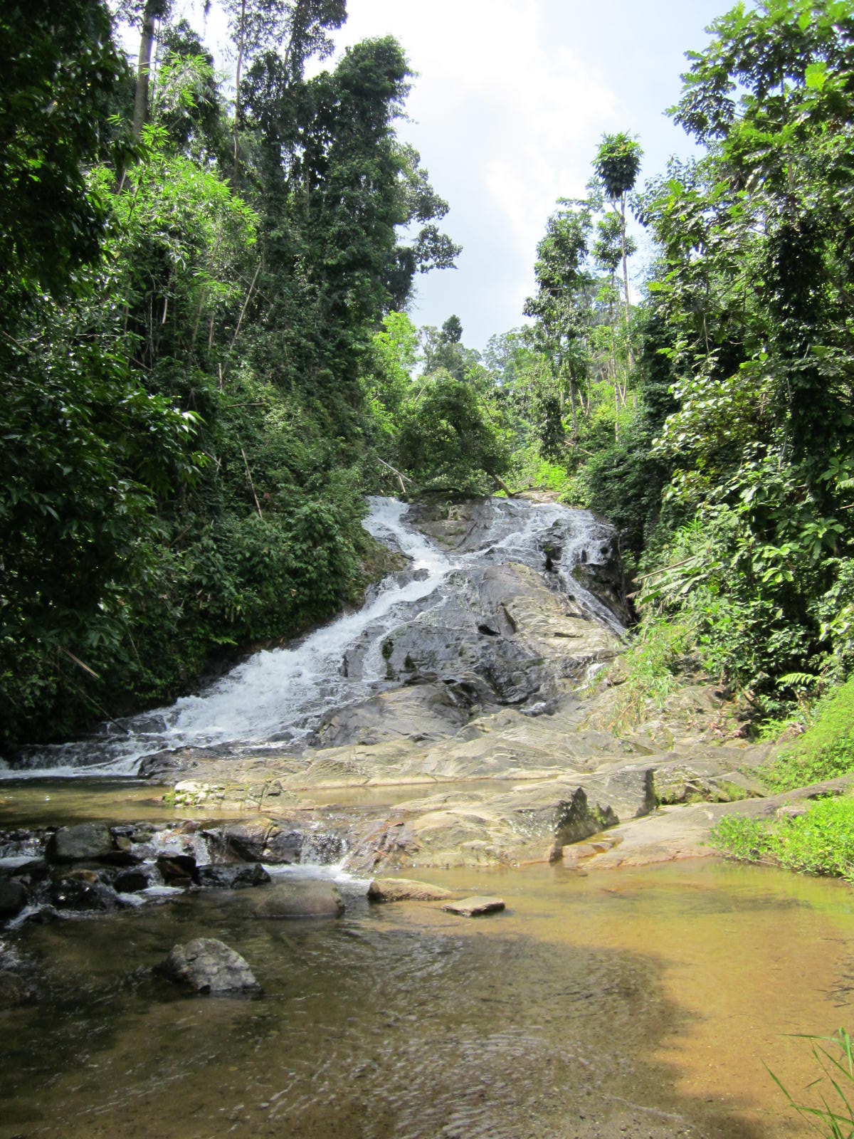
After stepping out of the car, one hears the rushing stream. Following a wide track and then a smaller track along a waterpipe, the 10 minute ‘trek’ ends at the foot of a nice 20 m high waterfall, Suan Mai.

Beneath the fall is a great pool to cool off and swim up for a natural back massage. Another nice find.


The surroundings are still very natural and pristine, despite the relative accessibility of these falls from the highway.


Interesting background knowledge is the website of the Andaman coast community tourism. It highlights some lesser well known waterfalls near Kuraburi. Other than this mention there is not much other information on the internet, it's very far away from anything remotely touristic, but as said a great find.

Sunday, August 7, 2011

Stacks


The lowest level seen from above

The details:
'This waterfall is located at km. 556-557 on highway No. 4 3 kms. from Kra Buri township with another 13 kms. on the leftside of the main road along the laterite road to the fall. Bokkrai Waterfall has many steps with fascinating nature surrounding'. source

Bokkrai, Bok Krai or Bok Kray. Sounds and looks pretty clear and this time around, it is clear. The road makes it all the way to Thungraya - Nasak wildlife sanctuary's entrance, another protected area along the spine of Thailand, straggling Burma or the Andaman coast. After we pay the 100 THB entrance fee (~$3) and receive a stack of tickets in exchange (good deal, 30 tickets of 10 THB instead of just the normal 3 of 100 THB), we proceed to the deserted car park just beyond the entrance.

Ranong's landscape is nice and lush, the minor road up to the sanctuary entrance winds it's way through mostly rubber plantations with the odd oil palm plantation thrown in for reasons of variation.


>Anyway once in the sanctuary, the bush is still lush but more lustrous. Quite wet, a good track goes to the namesake waterfall, only 200m away.

Bok Krai, the main lower level.

There one learns that there are more levels, 7 no less and we take the good looking track up. However the higher one climbs the more muddy and less maintained the track becomes, like having to fight oneself through a jungle.

But, what a beautiful place. Well deserted with some the gracious pools. I hate to disturb the free flowing nature with my own natural antics but why else come all the way from the modern world if not to merge with the natura?


Sorry for the disturbance!

Elsewhere on the net are another blog entrance as well as some more photo's by nobythai.

Monday, March 14, 2011

Falling Fairies

Entrance to Suoi Tien

Fairies
Suoi Tien is a commonly used name for a water-like attraction in Vietnam. Suoi meaning stream, Tien meaning fairy. So in English not as straight forward as commonly thought. Fairies are an often recurring theme in Vietnamese legends and with Suoi Tien, Khanh Hoa province the legend goes as follow:
'Legend has it that a giant from Binh Dinh Province visited Suoi Tien thousands of years ago. Enchanted by its charm, the giant accidentally slid into the stream. One of his feet landed on a boulder on the bank of the river, flattening it to create a smooth surface in the middle of the stream. The flat stone served as a place for fairies from heaven to play after coming down to earth for a swim. The flat stone is now an ideal resting point for visitors who want to conquer the upstream flow of the river'.
Note that the website from which I gained this insight has a photo of another stream (possibly for fairies) presumably more south (Mui Ne?).

The stream at entrance, with man-made pool.
Note the extensive scarring beyond, a sign of times to come


Getting There
Anyway, this Suoi Tien is located not so far from Nha Trang, the provincial capital. Passed the
17th century citadel of Dien Khahn one takes a left and continues towards the hills, sign boarding is unpredictable. There is also a number of internet sites that imply taking a turn from highway 1, south of Nha Trang in the village of Suoi Dao.
And finally a new by-pass is being built which will alter the directions altogether. The final 1 km up to the foot of the mountain
is a poor road , though small scale repairs were underway. A total of 20-25 km from Nha Trang (45 min.).

Plans are being drawn up, according to this reference:
'under a 15 year plan to build hotels, bungalows, regenerate forest, etc'.
So by then it should be less difficult to find!
Considering the amount of scarring this process (construction) is already resulting in (see photo above), the regeneration part will probably entail a long term restoration of what they had initially undertaken.
Sims [1] adds:
'Past the parking area a bar, restaurant, and tourist office are under construction. This once hidden gem is under wraps no more!
…
The downside to tourism is evident in all the litter seen strewn about, despite the odd rubbish bin'.
Other references are less expansive. LP [2] has a short paragraph on Suoi Tien:
'This enchanting spring seems to pop up out of nowhere.
…
It has been earmarked as the next big ecotourism site, which paradoxically probably means massive over-development, but it is still peaceful if you hike upstream'.
Anyway despite the nearness to Nha Trang and the obvious attractiveness for recreation, a week day mid-morning, March 2011, sees little or no crowds at all, quite sleepy.

Experience
An entrance fee is required (10,000 VND; ~ US$ 0,50) and then ione can wander up the stream. Despite aforementioned plans, there's still hardly anything to be had, at the entrance; even buying a drink is only just do-able.

The first set of falls which have been enhanced see a large crowd of drunk local teenagers, but continuing onwards through the stream bed one can seek solitude easily.

Enhanced

There's a passage below an overhanging rock and at a certain place an inlet for drinking water. Continuing through the bed stream brings one in still quieter places, though refuse still bears witness to a superior (?) civilisation.

Finally I find a nice sun drenched sandy pool and take an au-naturel plunge and reconnect with my inner-self. Birds everywhere, a nice place indeed.


More
Though not a waterfall in the strictest sense, it does contain many drops of a meter or more. There are a lot of pools to cool off in and if motivated one can continue onward up the mountain.
Sims [2] describes continuing as follows:
'Locals say that if you follow the stream to its source, about a two day hike, you’ll reach a magical chess board used long ago by fairies’.
Closeby is another stream, Suoi Nguon which according to Sims [1] misses the extensive development of the other nearby sites (see Ba Ho and Yang Bay) and signifies
‘it’s peaceful atmosphere with little to no other people around’.
Suoi Nguon can be reached by taking the road up Hon Ba mountain. Some pictures of Suoi Nguon are to be seen from this
web album.

Notes:
[1] Sims, A. (2010) Nha Trang Guide Book 2011-2012 Edition
EBT Media, Nha Trang, Vietnam.
[2] Ray, N., Y.-M. Balasingamchow, I. Stewart (2010)
Vietnam. 10th Edition. Lonely Planet, Footscray, Australia

Saturday, March 5, 2011

Intoxicating?


Suoi Ba Ho translates as "Three Pools Stream", which seems to give more credence to the waterholes beneath the three falls. In quick succession these falls find their way down about 100m of granite, hollowing out their lakes and creating a number of great swimming holes.

Unfortunately access is not fantastic. The turnoff from Vietnam's Highway 1 is 20-22 kms north of Nha Trang, the Khanh Hoa provincial capital, located on the south central coast. There’s a larger sign just before the small surfaced road. Three kilometers it says, which implies possibly 3 kms until a T-crossing with no sign there but where one needs to take a left. Continue onwards for about another 3 kms over a poor rough and tumble road, one eventually ends at a car park, in the process of being built into a bungalow park.

Well-shaded by tall trees, the rudimentary car park is along a sluggishly moving stream. On the opposite side are also bungalows being built, certainly marks of forward planning. Vietnamese ecotourism. The best part is that this is the worst part of whatever this development entity calls itself.
A quick payment of 20,000 VND (a fraction less than a US $) had ensured entrance but the destination was still a little upstream.

A wide track continues along the stream until it shortcuts a turn and hits the boulder strewn stream itself. From here to the first fall one needs to jump from rock to rock. One gets to the first lake (and fall) after about 45 minutes from the car park.


Surprisingly for a Tuesday mid March, there are two large groups of locals at the lower lake having a merry time, slowly getting intoxicated.

Did I tell you that the National Parks of Thailand want to ban alcohol consumption in their jurisdiction? According to the Nation (December 28 2010) On the one hand, that leaves us folks who can control our intake with empty hands, on the other hand, drunks playing the clown are a part of the past.

Anyway, there’s a track up the side of the canyon, a very steep track. Fifteen minutes up and it’s a steep slide back down. There is also the possibility to use metal rungs drilled into the rockside to pull oneself up to the next features. Up here there’s nobody to be found, a great place to dip the skinny, a personal first for me in Vietnam.


More info from internet are the pages on Ba Ho Falls:
'Therapeutic properties are attributed to the waters of the three pools at Ba Ho Falls'.
Asian waytravel:
'Ba Ho is primitive with its tortuous soil paths, grass covers and green trees drooping down to the rock bedded streams. The romance of nature makes travelers forget daily worries. The interesting thing at Ba Ho is that tourists can step over the rocks to get to the banks. The place is perfect for a picnic. Under the glistening sunlight, tourist can relax in the cool water.

For young people, relaxing in the water is not enough. With a stick and slow careful steps up the path heading to the peak, tourists can take a panorama of the three lakes. In the immense streams, tourists can swim to feel the pure, clear water'.
Ba Ho can be organized together with a boat tour to amongst others Suoi Hoa Lan waterfalls.

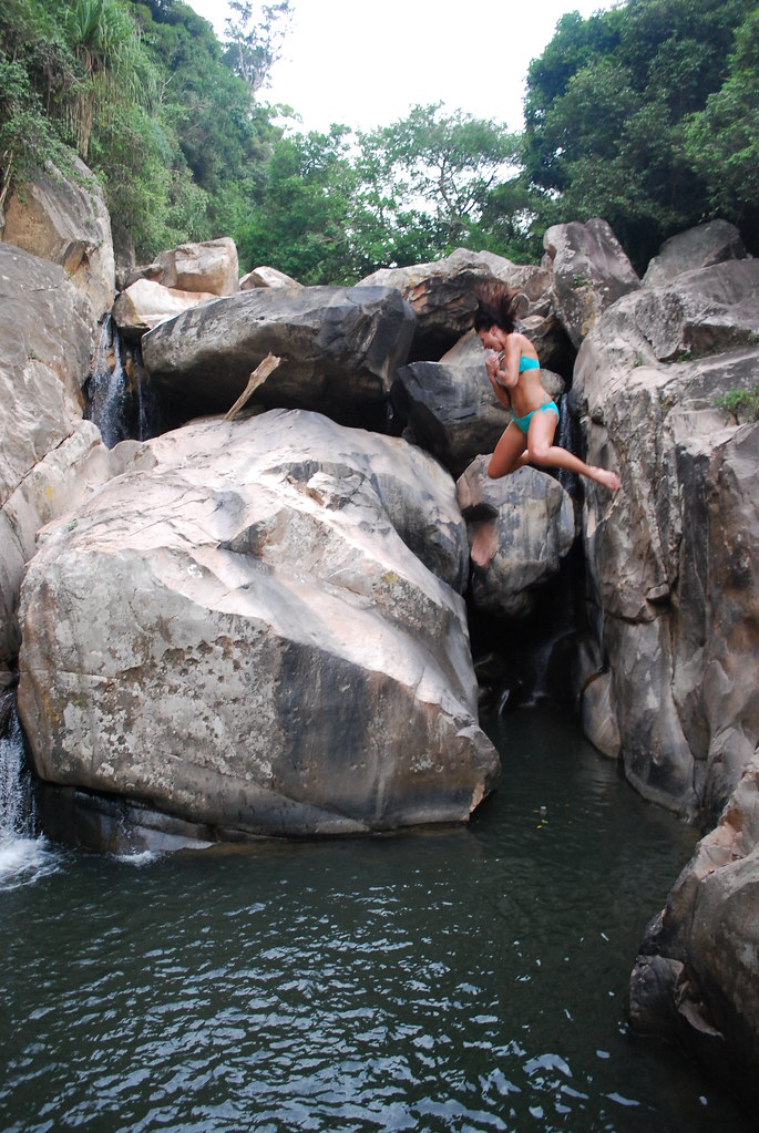
Above photo from internet is by jessia22 with the caption
'Nha Trang Ba Ho waterfall- Nadeane jumping'.

Wednesday, October 13, 2010

Couple of waterfalls

Lan Sang waterfall.

Located nearer Tak town than Taksin Maharat National Park (see also entry on Pang Ah Noi waterfall) is the national park of Lan Sang (sometimes written as Lansang). Just 17 kms along a gradually climbing towards the foot of the mountains road in the direction of Mae Sot (Highway 105).

As always there's a significant entry fee (~$US 7), but with the added benefit that the aforementioned Taksin N.P. is included in the same price if visited the same day.

Once past paying the road continues onwards along the Lan Sang stream for another km until one reaches a carpark. By then one could have already visited the Lan Lieng waterfall.
At the carpark there is also an information kiosk and after some search a toilet, oddly that they built two toilet structures next to each other.


A short amble gets you to Lan Sang waterfall itself. The waterfall is a small series of 5-10m drops between a rocky gully. Some good pools for splashing but as this is easily accessible it might be a little too public for my (and wife's) exhibitionist behavior. Or so it maybe construed. Careful.

Instead we notice the nearby signboard which mentions a number of waterfalls along the same riverulet but more upstream. All seem within an hours walk (the furthest, Pa Tay (Pha Te) is only a little more than 2 km away) and my wife and I decide to tackle the track to the next fall. The track alongside the stream is narrow and beginning to be overgrown. About 30 minutes up is Pa Pueng, the destination. This fall is much more open and is actually the stream going along a 20m slope rather than a real fall. Nonetheless a great place to hang out naked.

Pa Pueng waterfall during rainy season (October 2010).

On our way back we discover a much more worn track which though longer takes just the same amount of time. Once back we discovered we were just a short distance from the next waterfall Pa Noi.

More photo's of Lan Sang here and here.

This website provides a good insight:
'Legend has it that while leading an attack on Chiang Mai, King Krung Thon Buri became separated from his troops. In the dark forests, his soldiers were forced to wait for daylight to search for their beloved King. ' That night, a strange light appeared in the sky and the soldiers heard the King's horse whinny in the distance. They followed the horse's cries until dawn, when they came across their King mounted on his trusty steed. This site was aptly named "Lan Sang", the "Dawning Ground"'.
Related Posts with Thumbnails