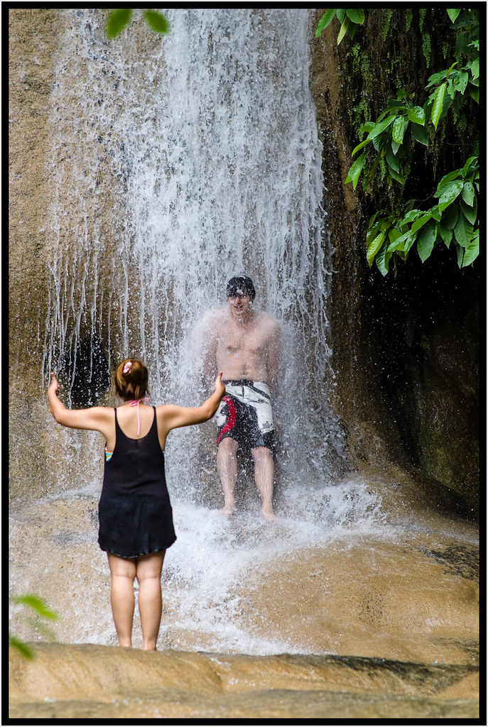
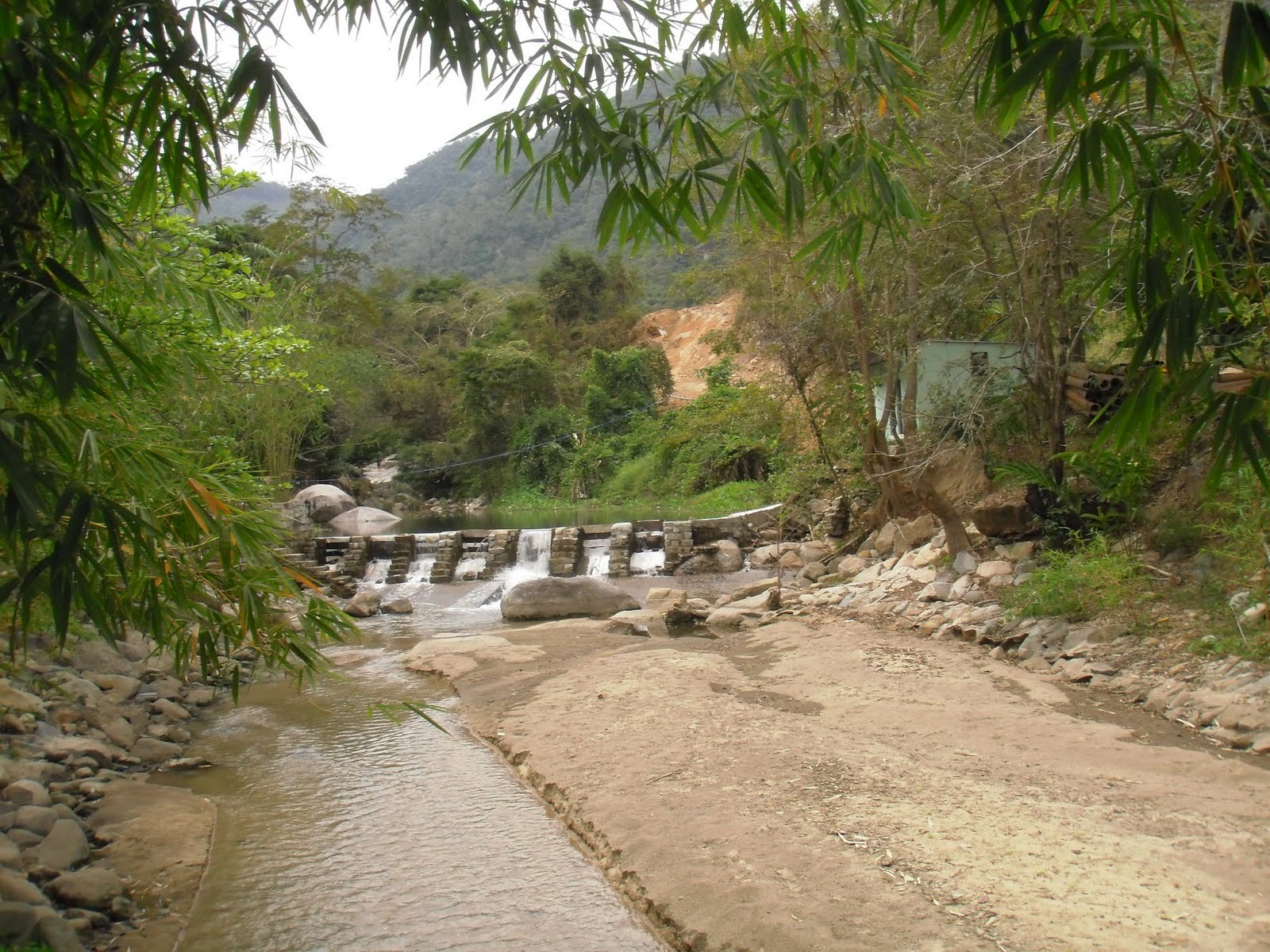
A couple of pictures and quite a bit of text. Should be the other way round.
Anyroad.
Starting off in the north of Southeast Asia.
The Lao government English language Vientiane Times has been going out and about, coming across a couple of waterfalls as it seems.
On Tad Phakxoyvoy (Jul. 15):
Anyroad.
Starting off in the north of Southeast Asia.
The Lao government English language Vientiane Times has been going out and about, coming across a couple of waterfalls as it seems.
On Tad Phakxoyvoy (Jul. 15):
And concerning Hadxaikhaoe:'This is a fascinating cascade located in an unusual natural setting in Nakhanthoung village, Xaythany district, about 40km from downtown Vientiane.Its attraction lies in the fact that unlike most other waterfalls it plunges over boulders in two separate streams of water, which flow in parallel in a sharp descent over a broad expanse of rocks.The waterfall is located within the 1,600-hectare Phou Khao Khuay National Bio-Diversity conservation area.In the rainy season, the level of the water rises and the cascades become more dramatic.The waterfall is very popular among local people and some foreigners also find their way here....
The waterfall can be reached by driving on Road No. 10 from Thangone village in Vientiane to Thoulakhom district in Vientiane province over a distance of about 40km. You then turn right to Nanokkhoum village and drive for a further 11km and turn right to get to the waterfall'.
'Many people were shocked to learn that there were waterfalls at the foot of the hills in the village of Kern, about 60 kilometres north of Vientiane.Today, the beauty of these cascades is not only recommended by friends, but has been widely referred to on social media after developers made the site more accessible a few years ago....From June to December, the falls here are spectacular as there is plenty of water and the sound it makes can be heard both day and night....At Kern village we turned right at the 37km intersection. Soon afterwards the green Khaokhuay mountains came into view some distance away to our left....Hadxaikhao waterfall was one of the few places that we visited. Viewed from a distance, it is a broad, meandering stream that winds its way down through the hills from far away, making a gradual descent....Huts have been built alongside the cascade where people can stay but few of them were occupied during our visit. Maybe that was because it was not a weekend....There are several waterfalls in this area, but Mr Bounmy said with a smile that on weekends lots of people visit this place in particular because Hadxaikhao waterfall is close to Pha Bath El Khan temple.Both the waterfall and the temple are about 15km from the junction with Road No. 10 to Pakngum district. When people come to worship the Buddha image at the temple, they also spend time at the falls'.

The water was freezing cold but when I saw the colour of the water I just had to get in! 💦 The scenery in Vang Vieng is amazing, with striking limestone mountains and caves, blue lagoons and small villages to be discovered. The town is very laid back but back in the late 1990s it was actually a party town where excessive drinking, drugs and fatal accidents happened quite often. The government had to shut down most bars and activities in 2012 and since then Vang Vieng has reinvented itself as an eco-paradise. 🌿
.
.
.
.
.
#getlost #optoutside #createexplore #exploretocreate #keepexploring #travelstoke #letsgosomewhere #vangvieng #welivetoexplore #allaboutadventures #darlingescapes #living_destinations #momentsofmine #traveladdicted #exploreglobe #speechlessplaces #femmetravel #girlsthatwander #discoverglobe #dametraveler #laostravel
Zip The Thai newspaper, Nation (Aug. 6) looks over the border at Tad Xai waterfall (Borikhamxay) and reports on the journey getting there, not really quotable. And thus wraps up the Lao section.
Let's cross the southern border of Laos.
From the Phnom Penh Post (Jun. 27) an article on eco-tourism in the southwest of Cambodia with waterfalls nearby:
'Seeing the potential of Phnom Tobcheang ecotourism, Seang Makara, founder of tour group Cambodia Camping, set up their first tour package to the area in 2016...."Now I am preparing to set up a resort up there. In fact, today Phnom Tobcheang Community has one completed resort and four other resorts in construction.”The community also offers a homestay ($3 per room for two people), breakfast ($2.50 per person), lunch ($3 per person) and dinner ($3 per person).According to their website, a local guide costs $10 per day, renting a tractor costs $25 per day, hiring a motorbike costs $10 per day, a bicycle $5 per day, a boat trip at $5 per person and a tent is $5 per night.To reach the community, travel down National Road 48 until you are 50m from Srae Ambel Bridge, at which point you turn right at the sign saying Hydroelectricity Plant Kirirom III. After two kilometres you then reach Longneth’s home, from where you will start trekking'.
There is actually quite a few articles concerning Cambodia's cascades. The Phnom Penh Post (Sep. 11):
'Khek Thuon is likely the first person visitors to the 30m tall Phnom Tbeng, or Thma, waterfall in Preah Vihear province’s Tbeng Meanchey natural heritage site.The almost 30m uninterrupted waterfall offers stunning views, and streams running off provide refreshing bathing spots shaded under tall, lush trees....Phnom Tbeng waterfall is 600m up Tbeng Meanchey Mountain – around 35km from Preah Vihear town.Tourists tackling its stairs pass the Phnom Tbeng or Dombouk Khmao pagoda after around a kilometre.After another kilometre, there is a choice of paths – one down to the bottom of the waterfall and another one heading to the top.Whichever one they choose, the lower and upper streams are connected by a tunnel-like path beneath the waterfall.The white cascade of water against the backdrop of the green vegetation covering the cliff walls make this the ideal spot to take photographs.“People rather take selfies here than bathe. For bathing, they usually choose the upper stream, which is another 200m or 300m further up,” Thoun says, sitting on a rock while keeping an eye on his clients.In timely agreement, a group of beaming young people coming down say that bathing in the upper stream was indeed a memorable experience.Tbeng Meanchey in Preah Vihear province – covering 25,000ha across five districts: Kulen, Sangkum Thmei, Tbeng Meanchey, Preah Vihear town and Roveang – was listed as a natural heritage site in 2016.Around 280km from Phnom Penh, Phnom Tbeng waterfall is reached by taking National Road 6, before turning north onto National Road 62 in Kampong Thom’s province’s Trapaing Russey commune.
Nearby Shinta Mani Wild has been included in Time Magazine's World's Greatest Places list as reported by Khmer Times (Sep. 4):
'At Shinta Mani Wild, the adventure begins before hotel guests even step onto the property. To get there, they’re whisked along a zip line over lush forests and waterfalls, after which they dismount for a drink at the reception’s Landing Zone Bar'.
Phnom Penh Post (Aug. 9) reports on a developed waterfall in Battambang province:
'The relaxation begins as soon as you see the blossoming yellow flowers lining the road leading up to the mango plantation.Passing through a large entrance with a sign saying “Welcome to Mango Plantation Waterfall Resort”, visitors drive down a wide road that dissects rows of thousands of mango trees dominating the landscape of Battambang province’s Samlot district.The main attraction at Chamkar Svay Waterfall Resort, as it is known in Khmer, is the river running through it, where visitors sit in gazebos eating and relaxing along its banks.“This resort attracts people since it is not developed. They love swimming and eating on mats, as well as relaxing until dusk before they go home,” Monn Mika, 52, the resort’s owner, told The Post.“I initially began planting mango trees without thinking about creating a resort. But with the mountainous water flow I thought it could be a tourism attraction. So I began developing it step-by-step until it started attracting many people.”Situated next to 87ha of land that after two years is entirely cultivated with mango trees, Chamkar Svay Waterfall Resort now welcomes hundreds of visitors daily who bathe in the river that flows from Chambang Mountain....Chamkar Svay Waterfall Resort is located in Sambout district’s Prey Sdao village, some 80km from Battambang town or 7km from Sek Sak Tourism Resort. Visitors pay 10,000 riel to bring their car into the resort'.
More like a set of rapids, see also the accompanying vdo.
Phnom Penh Post (May 23) again and another waterfall, this time in the province of Ko Kong:
'Situated in a suburb of Khemarak Phoumin city is a 20m waterfall, which runs down into a huge pond filled with fish as swimmers hurtle into the water from a rope swing tied to a tree.But what attracts many people to Ta Chat waterfall is the unique mode of transportation offered at the site – a modestly built funicular train to bring you to the top of the waterfall.Though funiculars are very common in many countries around the world, Ta Chat waterfall’s is the only one in Cambodia. The journey takes three minutes or so.“This was the initiative of our big boss to construct the mountain elevator in order to ease the walk to the top, especially for older people,” says Darng Deam, manager of the resort.The big boss Deam is referring to is Tea Vinh, a navy commander in the Royal Cambodian Armed Forces [!], who developed the area under the name Tourist Community Area of Ta Chat....The resort has a 20m waterfall, a 5m waterfall, as well as shallow water rapids for those who wish to bathe in quieter surroundings.“During the dry season, the waterfall flows very little water into the pool. April and May, the very hot months, have the least water and are the lowest season for tourists,”34-year-old Deam says.“But with the recent rains, the resort is looking fresh and the water has started flowing into the pool and swimmers will start to come gradually. In the rainy season we see a lot of water flow from June to January, we normally welcome at least 300 to 500 people per day.”
Khmer Times (Nov. 1) for a change:


'Hoang Waterfall was at one time in inaccessible jungle in Kampong Cham, home to only a few hermits and wildlife. Yet, it is now a popular tourist destination of the Tbong Khmom province, which was split from Kampong Cham in 2013. However, it is still quite tough to reach the waterfall even today.To reach the destination, located on the border of Memot district and Tambe district, you have to travel some 90 km east of the provincial town. Leading to Hoang Waterfall is a serpentine dirt path which branches off from the National Road Number 8 and very desolate. So it is wise to go on a group tour to avoid getting lost....Time flies and soon it is time to leave Hoang Waterfall. You have to leave before sunset because it will be another long way back, and you may not have time to see the breathtaking view from the hill when the sun sinks into the horizon unless you are bent on camping. No matter how upset you are with this: do not forget to bring your rubbish back with you because there is no rubbish bin here. To pollute such as a beautiful place is litter-ally sinful'.
More from the Phnom Penh Post (Jul. 11). It looks at waterfalls on and/or near Oral mountain.
Anger'It is 8km from Srae Ken village to a waterfall named Prek Snar at the mountain’s foot – a journey that takes more than two hours for tourists on a tractor driving down an unpaved road....Muth Pech drove his tractor with a large family from Thpong district and carried a speaker on his shoulder playing loud music.“We came for bathing and lunch together then we are going back home,” he said, as he took the family to Prek Snar waterfall, which has a slope resembling a water slide that plunges into a 1.2m pool.Soth is also a good chef, and he prepares lunch in the jungle with basic equipment.“Tourists order food with us, such as two chickens for six people, and we cook them in the forest with condiments, ingredients and rice. Normally we do chicken sour soup and grilled chicken that is enough for several people,” he said.Soth takes his guests on a more than two-hour walk after they get off the tractor.“From the lower stream, we visit Smounh cave where we have installed beds to relax. We also visit Bak Kanhchherl, Steung Kroul and Korki creeks, which all have cascades. If people want to see all the waterfalls, spending just one day is not enough,” he said'.

kaela_rayne at Loboc on Bohol island
Who wants tan lines anyway...
Not so much to report on from Philippines, only a couple of lists.
Gamintraveler (updated Oct. 17) has a posting with just 50 Filipino waterfalls.
Trekeffect (Jul. 10) looks more secretively at the waterfalls of the Philippines:
'Visiting a waterfall is probably the most relaxing and, at the same time, fulfilling kind of nature tripping. The sound of the water, from above crashing down below, is not only the best takeaway in the entire experience but the visually stunning greens surrounding it as well.Here are some of the Philippines’ best-kept secret waterfalls'.
Deztreks (Oct. 22) has a catchy intro:
'This week we will take a look at the best 8 waterfalls in the Philippines. However, since writing this original article, there are six more waterfalls that I have been to that I want to include in this article.Therefore, I have revised this article to the Top 14 best waterfalls in the Philippines.One of my favourite comedians uses a line in his routine which says something along the lines of “how can you be angry at a waterfall?”.He was trying to make a particular point in his routine but what he said is really true. How can you be angry at a waterfall?
Freeoversea (Jul. 1) have a waterfall guide, but solely for Cebu island:
'We decided to hop on a two day adventure through the south part of the island, chasing waterfalls and found some really good ones'.
More (or actually quite similar) Cebu waterfalls from expatworldtravel (Sep. 5).
Seventyonemag (Aug. 27) has a feature on the tallest waterfalls of the archipelago.

moritz.m.w at Kanching (Selangor):
🌊🍑
A couple of mentionable lists from Malaysia.
The Smartlocal (Sep. 30) has 15 gorgeous Malaysian waterfalls:The Star (Nov. 22) has 5 waterfalls in Selangor on offer.'Try chasing waterfalls in Malaysia – there are about 100 waterfalls there, with more being discovered with time. Here, we list out 15 waterfalls that are relatively easy to get to, with no special gear needed'

That one time I went on a motorcycle adventure in northern Vietnam and competed with 60 people throughout 3 days. One of the challenges was to skinny dip near a waterfall. Getting naked wasn’t so hard, it was finding this dang waterfall. Such lovely memories. One day I’ll return.🇻🇳 #namduro250 #vietnam #motorcycleadventure #challenge #travel #southeastasia #womanthatrideThus, over to Vietnam.
Vietnamplus (Oct. 6) comes with this snippet with special news:
'The 2019 Ban Gioc waterfall festival opened in the northern border province of Cao Bang on October 5.itourvn (Aug. 21) lists 3 waterfalls near Dalat, central Vietnam.
The two-day event is jointly held by the provincial Department of Culture, Sports and Tourism and the Trung Khanh district People’s Committee.
It is designed to promote the images of Cao Bang, Ban Gioc waterfall and cultural traits of ethnic groups in the province to domestic and foreign visitors, thereby contributing to the province’s socio-economic development, security-defence, investment attraction, tourism and trade.
The centrepiece of the festival is a light festival held on the waterfall, featuring modern sound, lighting and laser technology.
Various rituals and festive activities are also arranged, including a water procession ceremony to pray for peace along with favourable wind and rain; a photo exhibition and a folk singing event.
In addition, locals and visitors have the chance to join folk games such as tug of war, sack race, stick pushing and chestnut cracking.
Ban Gioc is the largest natural waterfall in Southeast Asia and also the world's fourth largest cross-border waterfall'.
Hideout
Indonesia's contri comprises mostly Bali.
Let's start with non-Bali links. Indonesiatravel (Sep. 12) has 10 refreshing waterfalls on Java.

Tannedtravelgirl (Jul. 16) reports on what to do near Tetebatu, Lombok.Waterfall showers. E'ry. Day....#chasingwaterfalls #temanggung #javaisland #indonesia #natureshower #naturalbath
So Bali then.'3 waterfalls: Sarang Waltet Waterfall, Benang Stokel and Benang Kelambu'.
Remoteandafloat (Jul. 26) has a presentation on waterfalls on Bali:
A great article.'If you’re a nature lover with an adventurous spirit then discovering the best waterfalls in Bali should definitely be on your to-do list! The island is home to some of the worlds most beautiful waterfalls, and exploring them is one of our favourite things to do when we are in Bali....In at number one, is one of our favourite hidden gems in Bali.We had no idea that this secret hideout even existed, and could not believe our luck when we stumbled upon it. Bhuana Sari Waterfall is actually Banyu Wana Amertha’s big sister, and can be found just a little deeper into the forest....As waterfalls go, Bhuana Sari ticks all of our boxes – impressive, secluded, swimmable and away from the main tourist trail. Thats why we’ve named it the very best waterfall in Bali'.

womanbewild at Sekumpol:
I don’t want to live on the earth, I want to live with the earth.
Au.hotels (Sep. 19) has 22 waterfalls on Bali to feature:
'The best waterfalls in Bali are hidden treasures that you can find in lush rainforests and deep mountain valleys in the island’s central highlands. They’re among the great sites to add to your list of adventurous things to do in Bali. Most are at the end of scenic routes, usually requiring treks past rambling creeks, and you may sometimes need to cross wooden bridges and descend a series of rocky steps.Upon discovery, these popular Bali waterfalls reward you with immersive experiences. You can take a dip in the pebbly pools under cascading falls for a soothing break. Some of Bali’s best waterfalls let you take in their magnificent views from down at their surrounding base or from above adjacent hilltops'.
Honeycombers (Nov. 24) has 14 of the best Bali waterfalls. Good pointers and info. This concerning Lekeleke:
'Full disclosure: we found Leke Leke Waterfall by accident, but boy are we glad we did. Slightly off-the-beaten-path and lesser known compared to Bali’s other big-name falls, Leke Leke remains somewhat of a secret. And you know what that means? Smaller crowds. In fact, when we were there we didn’t see a single other tourist (hoorah!). To get to down to Leke Leke, you descend a slightly steep (but already carved) dirt track to the bottom of a lush valley, before shimmying over a rickety bamboo bridge and through tropical jungle. You’ll hear the falls before you see them, and when you do, you’ll spot the breathtaking surge of bright white water falling between a dramatic black cave. A large rock at the forefront makes for the perfect perch to nab some Insta shots, while the small pool of water at the falls’ base is ideal for a refreshing dip'.

Slightly off-subject. Or not. The Sydney Morning Herald (Oct. 13) discusses current insta culture with reference to Bali and highlighting a visit to a waterfall:
'In our selfie-obsessed, social media-drenched age, tourists to the Indonesian island of Bali are going to ever more extreme lengths to get the perfect shot.But in the quest for that unforgettable photo, some people have paid with their lives.Three of the most popular places for foreign tourists to have their photos taken on Bali are the Lempuyang Temple, also known as the Gates of Heaven, the Kanto Lampo waterfall and the Devil's Tears, on nearby Lembongan Island....Up to a thousand tourists a day visit the stunning Kanto Lampo waterfall, about 90 minutes from Denpasar. Many stand around in their bathers in knee-deep water for as long as two hours to clamber up the rocks to spend five minutes artfully posing.Australian woman Rikki-Lee Rial and her daughters Zydeakkah Smith and Kyleeka Smith are on their first holiday in Bali and decided to visit the falls after seeing photos online. "I did my research on family places [to go] before coming, this place is not exactly a family spot, but I saw the beautiful photos."
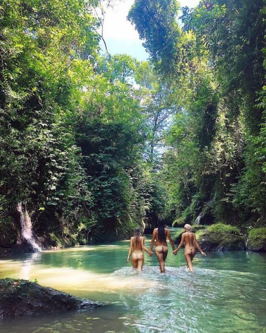
maxinnebjork near Ubud:
Adorned Sharing love in nature - blessed to live on this earth. Beyond magical to be able to start my mornings with friends by the waterfalls in the jungle. Fueled with energy 💥💥🔥.
Bangkok Post (Aug. 12) reports on the problems faced by monsoonal deluges:
'Part of the popular Erawan waterfall in Si Sawat district of Kanchanaburi has been temporarily closed after heavy downpours damaged a path to higher tiers, but the access to all levels is expected to be restored on Tuesday.Porayut Waiwong, chief of the Erawan National Park, said on Monday that days of heavy rain had pounded the waterfall and damaged the path between tier 6 and tier 7. The steep, rocky path had become muddy and slippery, making it unsafe for visitors.On Sunday, several tourists were injured on the muddy path, prompting the national park to temporarily close the two levels'.

Hands down, this is one of my favorite memories from traveling! A dear friend and I were skinny dipping in a waterfall in Northern Thailand, adorned with leaf crowns and joyful smiles. Thanks for the inspiration @hopscotchtheglobe! #HTGmoment
In quite improbable news (quotes from the Guardian, Oct. 6), 11 elephants have died due to a fall near a waterfall in central Thailand:
'Wildlife officials in Thailand have discovered the carcasses of five more wild elephants downstream from a waterfall where the bodies of six other elephants were found on Saturday.The animals were originally thought to have died while trying to save each other after falling into a waterfall at Khao Yai national park, but a drone being used to investigate the deaths later identified five further carcasses, including that of a three-year-old calf.Only two elephants in the herd are known to have survived the fall at the 200-metre-high Haew Narok waterfall'.
Waterfalls also are a danger to humans.
CNN reports (Nov. 15) on a French death on Samui. The waterfall in question (Na Muang) also claimed a victim back in August (Euroweekly, Aug. 1).
Btw, Malaysiafaces the same problems. The New Strait Times (Sep. 26) reports on a waterfall death near Kota Kinabulu as well as another in Selangor (Aug. 7), while on Sep. 7 another death is reported from Bentong (Pahang). Worldofbuzz (Aug. 12) notes a death at Sungai Lembing (Pahang).
No lessons learnt then?
CNN reports (Nov. 15) on a French death on Samui. The waterfall in question (Na Muang) also claimed a victim back in August (Euroweekly, Aug. 1).
Btw, Malaysiafaces the same problems. The New Strait Times (Sep. 26) reports on a waterfall death near Kota Kinabulu as well as another in Selangor (Aug. 7), while on Sep. 7 another death is reported from Bentong (Pahang). Worldofbuzz (Aug. 12) notes a death at Sungai Lembing (Pahang).
No lessons learnt then?
Possibly, as above with Erawan, Xinhua (Oct. 21) reports on 6 waterfalls closed. Note we are back in Thailand:
Thaiger (Aug. 18) mentions a couple of other waterfall closures:'Thailand's Department of National Park, Wildlife and Plant Conservation announced on Monday that six waterfalls at Khao Luang National Park in Nakhon Si Thammarat Province would be closed from Monday until further notice'.
'Doi Suthep-Pui National Park officials in the north of Thailand have closed the Mae Sa and Tad Mork waterfalls after heavy rainfall have caused high water flows and slippery paths “that may endanger tourists”.
Openings then. Phuketnews (Aug. 7) notes an expansion of forest areas falling under the national park authority. These very often include waterfalls.
'The Tourism Authority of Thailand (TAT) has announced that Thailand has added five new national parks around the country during 2016 to 2019...From 2016 to 2019, Thailand added a total of 331,952 rai (53,120 hectares) in additional forest area to its national park system, the TAT noted in its release.“This brings the total forested area in Thailand to over 102,488 million rai, representing 31.68% of all area nationwide. It also signals the progress made in adding more protected forest area under the jurisdiction of Thailand’s fast-growing national park system,” it added'.
Protection in action. The Bangkok Post (Oct. 18) has a look at eyesores at waterfall sites in the south of the kingdom:
'Another concrete platform has been built into a waterfall in Nakhon Si Thammarat province, prompting officials to order vendors to remove the encroachment by Saturday.The Chom Rom Strong-Jit Porpiang Tan Thudjarit on Friday posted pictures of the concrete block at Tha Phae waterfall in Khao Luang National Park in Chang Klang district and called out park officials over their failure to crack down on encroachers'.
(a: yes @no. 22)

Next adventure = scootering to Pai! We stopped at Mok Fa waterfall on the way. Even the murky water didn’t stop Drew. ➡️ to be 🌙’d. 🙈🙊#skinnydipper•Here’s what happened after this photo was taken...So Pai is about 3 hours from Chiang Mai. Sounds easy right? Well this was our first scooter experience and we didn’t do much research regarding the road to Pai. Come to find out, the mountain pass has freakin’ 762 turns! 😳 Which we did in the dark, in the rain, and in shorts and tank tops (because we were coming from Chiang Mai which is hot 🥵 and not knowing we were going to be climbing up a mountain in the dark 😂). Also, the drivers here have no hesitation for popping over in your lane EVEN AROUND CORNERS. Needless to say, we saw quite a few trucks in ditches. Anyways, we were freezing our butts off, and praise the Lord there was a little shop on the side of the road near the top 🙌🙌🙌🙌 And it had jackets!! 🙌 The funny part is that the only one that fit Drew was a 1980s bright pink tie-dye women’s ski jacket 🤣 Check out our story for a picture!•Pai is beautiful though and worth every crazy turn of that drive ☺️ Now we just have to make it back to Chiang Mai 🤣•••#goplayoutside #openmyworld #bestvacations #exploringtheglobe #travelawesome #roamtheplanet #travelon #liveauthentic #letsgosomewhere #wildernessculture #visualwanderlust #meettheworld #starttheadventure #amazingtravelbeauty #chasingwaterfalls #waterfall #waterfallfordays #seekthetrails #awesomeearth #nature_obsession #nature_seekers #planetdiscovery #welivetoexplore #travel_regram #travelinginyourlove#timeoutsociety #globecouples #paithailand #mokfawaterfall