Showing posts with label น้ำตก. Show all posts

Tuesday, May 1, 2012

Up the creek


Easily accessible from the most touristed stretch of the Khao Lak coast (Phang Nga, Thailand), it could be expected that Chong Fa would be nearly overrun or near ruined. However the opposite is true.

'Please do not entry to the waterfall'
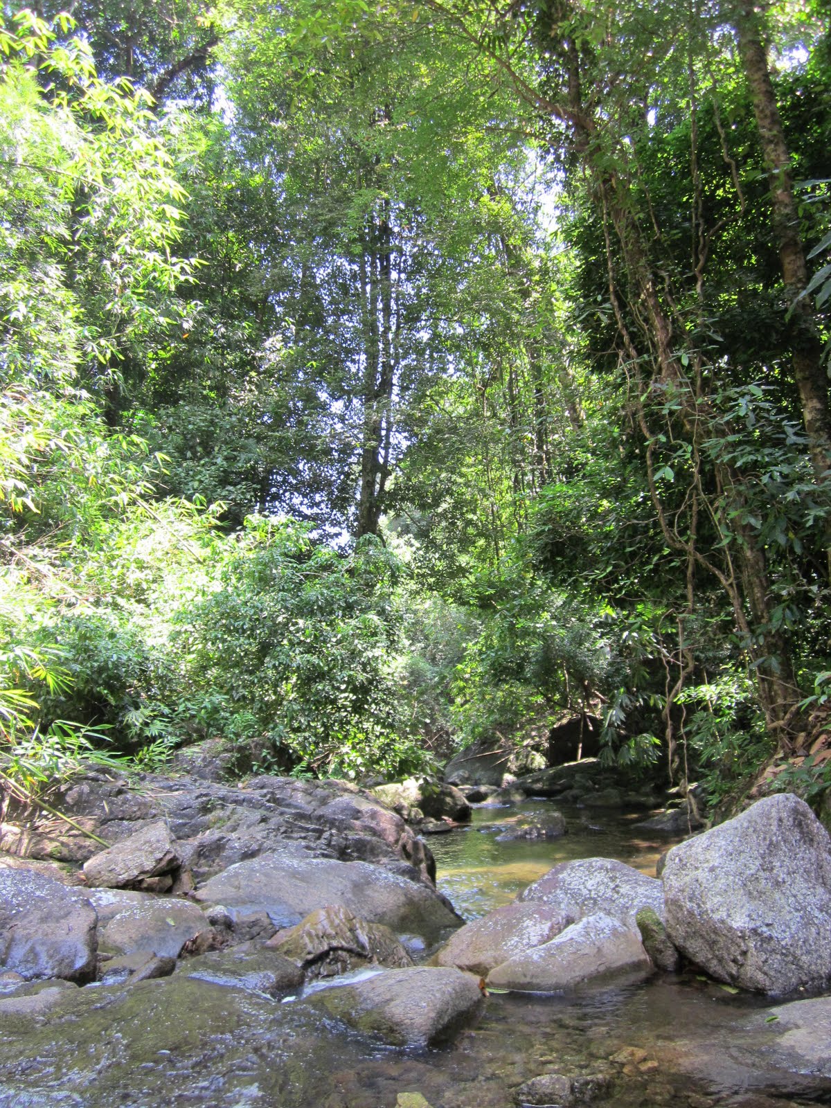
The entrance gate (Chong Fa is part of the Lam Ru National Park) is half open or half close with a poster revealing that the park is somehow off-limits (photo above). A plus is that the park is (still?) open. Furthermore, no entry fees are required. And once again the access road is too difficult to take. There is a lone ranger, but he has his pitched his hammock up high and is wondering what his dreams will bring him.

From the entrance to the waterfall is a 1km long access road. From the road head it’s another 200m walk along a track to the first level, so no real strenuous hike, but a deliteful one nonetheless.


Getting there is a big part of the experience.
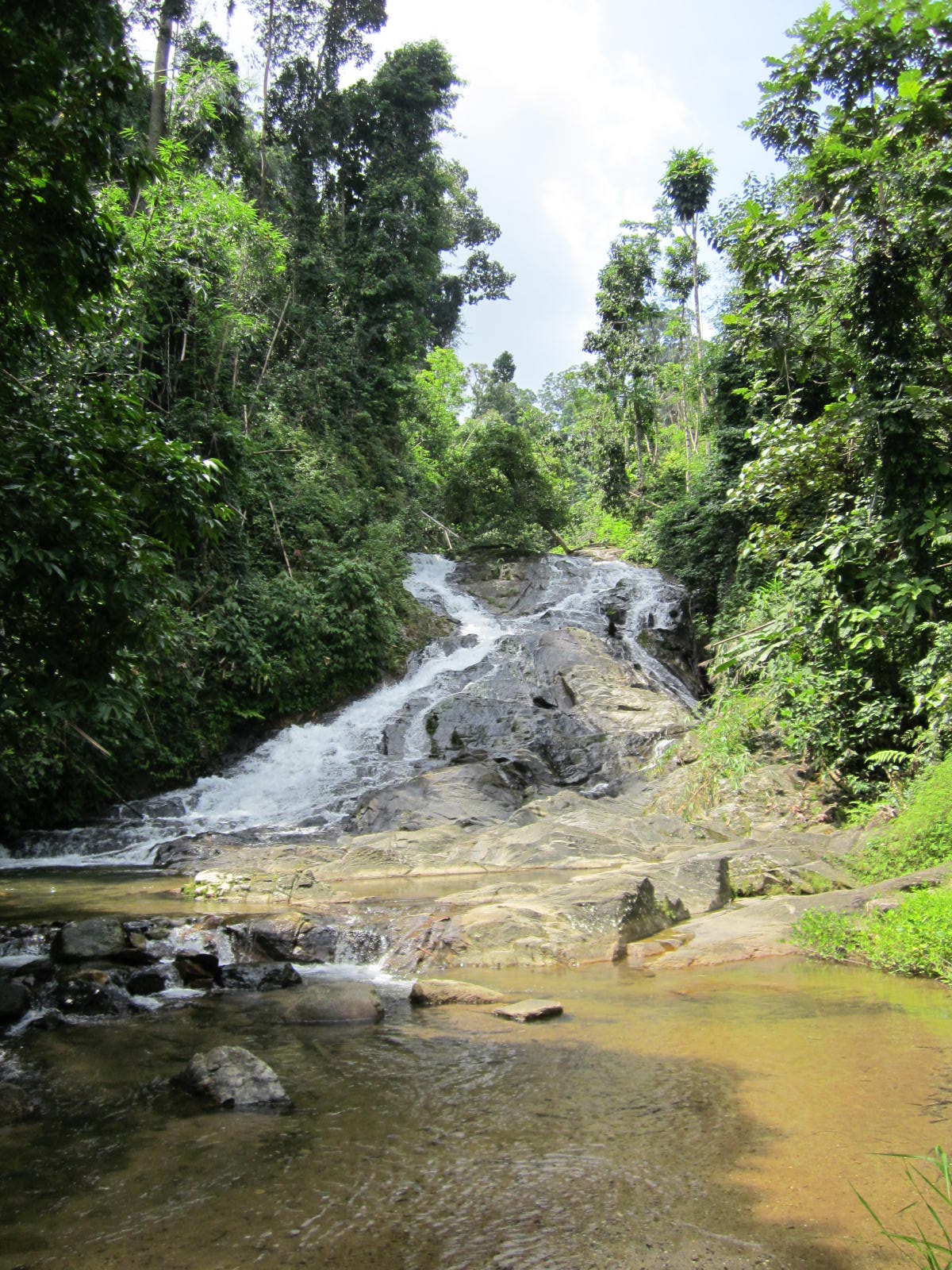
Chong Fa is a fabulous waterfall with lots of water crushing down into a deep and sunny pool. Downstream along the access road, are more swim holes, all deep and free flowing with great opportunities for a great dip.

It really is amazing, this piece of paradise so close to the paradise lost of Khao Lak.


There’s one website which has some more info on Khao Lak’s waterfalls (it mentions Chong Fa as having a steep (!) track to the first of five levels), but in general Khao Lak’s waterfalls are neglected and ignored, despite these being a great way to diversify the coast’s attractions, generate income and able to increase awareness of the globe’s natural surroundings, their fragility and the unique experience they offer. It contrasts with other places nearer Bangkok where waterfalls have become attraction parks, places of recreation.

But for me the tranquillity and (temporary?) absence of the great world is an opportunity to indulge in swimming, plunging and receiving a natural back massage.
Chong Fa, back massage please!

Wednesday, April 4, 2012

Deserted & ditched


The waterfall named Kha On (or Thap Mon) is another great find. A difficult one to find, it is just 13 kms from the main road, not far from Thap Sakae, Prachuap Khiri Khan.

The road gradually deteriorates and after passing what might be a ranger post (Kha On is part of Huai Yang National Park), a decision is made to ditch the car before going down the hill to find out that a return would be impossible.

Five hundred meters beyond the spot where we left the car behind, is indeed what might be referred to as a car park, with a toilet building nearby. Deserted on a week day, the height of the grass also points to the lack of an enthusiastic pack of waterfall hunters, yea!


An excellent path explains the nine levels and with swift jumps the no. 9 is coming ever closer. After half an hour, we have passed all levels and arrive at the uppermost level, described as a 15m drop which we will contend is the truth.

Level no. 9

The
other levels though are just small breaks, some hardly registering a drop.

Kha On is another beautiful undiscovered place. And well-maintained.


If one understands Russian see this blog. It doesn't add much, but many photo's.

Thursday, February 23, 2012

Ask


Heading for Ton Phet waterfall (น้ำตกโตนเพชร), Ranong, Thailand, there are a great many signboards indicating the direction required to take. Mostly at places where the direction is, in reality, so obvious.
However where they lead us to, is the start of a rutted track, where one should most probably continue upwards.

The car is ditched and the climb attacked. Fifteen minutes later, the climb comes to what was once a nice park-like setting with a view of the waterfall. The view of the waterfall on the opposite side of the valley!

Had one, though, taken a footpath along the river, before the climb, one would have easily reached the foot of the 11 levels of water gushing from the jungle to the partially developed valley.


The Ton Phet waterfall is just west off the Highway 4, heading south from Ranong town. The 2 km access road winds itself through rubber and palmoil plantations and the last stretch of road slowly deteriorates and becomes unsurfaced as it gets steeper. There’s a ford to cross after which you would have to make a decision, the fall proper or the view.

Unfortunately a simple internet search would have revealed
'Visitors are recommended to ask villagers in the area for directions'.
Cathy and Gary on vitualtourist report
'After lunch we headed for Ton Phet Waterfall, it took us ages to find this place, off the main road onto rough dirt tracks, talk about being out in the wilderness, I kept thinking what if we cant turn around at the end as in places the track was quite narrow.
Eventually we came to the end of the track and there was some sort of small waterfall with an old rickety falling down bridge going across the stream.
We didn’t stay here very long and decided to explore another little track off to the right, this track was a bit boggy so there was a little bit of sliding around.
At the end was a lovely swimming hole with a Thai family bathing, it was a great spot, perfect for a drink break'.
There is another photo on Panoramio.

Monday, February 6, 2012

Go

Close to Prachuap Khiri Khan town is the lesser known Khao Lan waterfall.

Part of the
Huai Yang National Park, Khao Lan is just one of the five major waterfalls of this park, which runs from the lower hills to the mountains on the border with Burma. Highway 4 south from Bangkok leads one along many easily accessible waterfalls. Khao Lan is just 14 kms off the highway but a total different world.

From the highway, one turns land inwards until a small roundabout, take the left road and continue along this road as it gradually deteriorates. We take a wise decision to park near a banana plantation, about a km short of the end of the road. The last km is a very steep washed out road, to be tackled only with a 4WD. A total of possibly 14 km from the highway.


At the end of the road is a national park office though their role seems to be insignificant. The track along the stream to the 5 levels of the waterfall is (contrary to the access road) well maintained, Khao Lan is another beautiful walk, not too strenuous (we are after all in Thailand) but natural enough to ensure the experience.

Despite the well maintained trails, the place is deserted. Another great piece of the amazing country to relax. Pack a lunch at the main highway near the turnoff, the well signposted Coffee and Go is good place and different to the usual Thai roadside restaurants.

Overnite stays can be done in Prachuap itself, a nice relaxful seaside place.

Tuesday, January 24, 2012

From a distance ...


Namtok Ngao waterfall is located just outside of Ranong town, heading southwards. It is not to be missed as this cascade spectacularly falls over the cliffs, just a couple of kilometers from the main road (see photo above).

Especially spectacular towards the end of the monsoon, they are still very discernible from the road at any time of the year.

Getting close up is possible by getting entry to Namtok Ngao National Park. Another good source of information is here.
Mostly covering the main mountain ridge, there are a few other waterfalls in this national park, but none as easy accessible as Ngao. That said, the waterfall is something to be seen from a distance, rather than up close where the specific spectacularity fades.
Such that a nearby treeless hill (Phu Khao Ya) actually acts as an attractive view point of the Ngao waterfall, 10 kms away!

There is a hot spring not too far away from the main road in the same Namtok Ngao National Park, Porn Rang. Having been spruced up to the tune of $1 million (source), it's a very entertaining place to take a soak and enjoy the scenery. And the national park plays host to Pu Chao Fa a rare freshwater crab (source). Another great fact.

Saturday, January 7, 2012

Massage please

Don't enlarge this picture!

About 10 km south of Suk Samran, on Thailands Highway 4 between Ranong and Takua Pa, just north of a bridge, an attentive passer-by will see a wearied and worried signboard, pointing inland, inwards to Suan Mai waterfall, part of Sri Phang Nga National Park, home to many new and unknown waterfalls.
The small road first passes some kampong houses, crosses a bridge and slowly climbs up through rubber and palm oil plantations, interspersed with some durian orchards, ripe for the picking.
The road deteriorates, then improves. After deteriorating again, one needs to continue going straight in a sharp left hand corner.
The road gets steep and enters a protected environment with what was once a parking area before a steep hairpin to an office with some tired looking government staff.

After stepping out of the car, one hears the rushing stream. Following a wide track and then a smaller track along a waterpipe, the 10 minute ‘trek’ ends at the foot of a nice 20 m high waterfall, Suan Mai.

Beneath the fall is a great pool to cool off and swim up for a natural back massage. Another nice find.


The surroundings are still very natural and pristine, despite the relative accessibility of these falls from the highway.


Interesting background knowledge is the website of the Andaman coast community tourism. It highlights some lesser well known waterfalls near Kuraburi. Other than this mention there is not much other information on the internet, it's very far away from anything remotely touristic, but as said a great find.

Thursday, November 3, 2011

Plunge jacuzzi

View from the old road

Ease of access is key to most Thai waterfalls, but seldom is access so guaranteed as to Punyaban (or NamTok SetTakuat, source) which falls nearly onto highway 4, just north of Ranong town.

In the sharp U shaped turn, the old bridge and both banks are used to create a park like area with the 50 m waterfall as natural backdrop. Near the parking areas are two small restaurants as well as amenities block (or two). One can walk below to the stream level and safely go up to the base of the waterfall.


Strongly recommended is to take the nature trail path on the north side. Steep, it’s well laid, though not often utilized. The educative element has slightly became a victim of time, the trail itself climbs beyond the lip to a smaller fall and beyond this to a 10 m fall.

View towards Myanmar

With a beautiful view as well as the solitude gained so close to the mad world as represented by a major highway, this area above the larger waterfall entices one to become one with nature and plunge in the natural rock jacuzzi’s or get immersed under the falls them selves.

Up beyond the main waterfall are some great skinny dip pools.

More info can be obtained from cathy and gary's travel page entry on Punyaban. Note that the waterfall i s just 10 minutes drive north of Ranong town, it counts 3 levels but only 20m height. Their end note:
'Punyaban Waterfall - Beautiful Place'
Others mention the nature trail heads back down on the other side.

Lonely Planet rates Punyaban as no. 5 of the 11 things to do in Ranong.

Interestingly the blog waterfallsonstamps names Punyaban as one of his 9 stamps of waterfalls from Thailand (from 1980, 2 THB!).

Anyway, Punyaban is definitely a contender for top 10 waterfall position in Thailand.

Just one of the pools waiting for you to quit your sweaty clothes!

Sunday, October 2, 2011

Rainbow splashes

Such is life. There's hardly anything of notice at Chum Saeng waterfall, but still the 3-legged dog wandered down the road for 200m just in case.

A great road for waterfall hunting is the road between Chumphon and Ranong, especially on the Ranong side of the water divide.

Chum Saeng waterfall is the first signposted waterfall along the way, km's from the main highway interchange 80 km's before Ranong. It's on the south side of the road near km's 529/530. The waterfall is only 3,5 km from the main road.

The local roads department have foreseen larger things for Chum Saeng and have built a two lane highway from the main highway straight to the foot of the falls. Nothing has been left to coincidence and a once beautiful park-like surroundings would have existed. Not anymore unfortunately, as maintenance has failed to keep up with visitors resulting in a under utilization of the site as well as the slow accumulation of refuse making it increasingly desolate location.

It’s a nice view though, 50m or so of the fall. Further back the view is more impressive than being just underneath the fall.

RideAsia.net have gps coordinates (N10.30.030 E098.53.029) though they also mention there was no water in the falls during the dry season. Wikipedia adds:

'In the rainy season, a lot of water cascades down the boulders in rainbow splashes. This is how it is called “Namtok Sai Rung” or Rainbow Waterfall'.
No rainbows in the dry season!

No quite a rainbow yet.

Thai-tour.com adds:
'Sai Rung which means a rainbow in named according to the splashing figure of the waterfall resulting from the strong hit of the powerful water agains rocks'.

Friday, September 2, 2011

Of mannequins and monks


Sometimes you come across a waterfall with a difference. Huai Yang waterfall has something different. Namesake for the surrounding National Park (meaning the requirement for a 100 THB entry fee ...), it's obvious it sees huge numbers of visitors, based on the well paved car park. 

Despite this being a weekday, a few cars are pulled in and on the opposite side of the creek is a huge huddle of white clad students acting as if they are listening solemnly to some speech or another.

Unfortunately, just when we hit the track so does the group and swamped by white shirts (which political direction do they support?) we climb up the track. It's a nice climb, once in front of the group.


Keeping ahead and looking behind: level 3.

Up on the ridge one gets to a small shrine. Beyond is a big pond at the foot of a slender fall, the third level of five. Possibly already wearied down tourists are hanging around. But there are more levels to explore. One can jump over rocks to the other side, followed by a scramble over bare rocks. The stream equally forces it's way down over mostly short scrambles. We reach the next level, a delicious pool with a great 15 m fall on the opposite end.

Oddly enough a monk is here, feeding the fish (see lead photo, above), mostly catfish and carpers, largely ornamental varieties. It's a disturbing trend in the maintenance of what are essentially national parks, rearing fish, so as enhance something or another. The more frequented waterfalls of Thailand (read Erawan, Pa La U) seem to be teeming with fish and considering the regular feed supply, it's no wonder.

My son vehemently opposes any swimming with any fish, while my wife decides that it's not her day. I wait for the monk to totter off, undress (that's me) and enjoy another spectacular part of Thailand's nature. Meanwhile  praying the fish won't nibble my special parts ...

Alex has a number of photo's, but other than that there is not much than the obvious reference on how to get here: located in Prachuap Khiri Khan province, the waterfall is conveniently accessible from the major highway south (km 350), only a 7 km ride to the foot of the mountains.  

There's panaramio.  

And travelfish.

Ursula's weekly wanderings has an interesting entry on the spirits of Prachuap Khiri Khan including some photo's which really are weird kind of spirits (mannequins?) which are to be found near the shrine at the first level.

Sunday, August 7, 2011

Stacks


The lowest level seen from above

The details:
'This waterfall is located at km. 556-557 on highway No. 4 3 kms. from Kra Buri township with another 13 kms. on the leftside of the main road along the laterite road to the fall. Bokkrai Waterfall has many steps with fascinating nature surrounding'. source

Bokkrai, Bok Krai or Bok Kray. Sounds and looks pretty clear and this time around, it is clear. The road makes it all the way to Thungraya - Nasak wildlife sanctuary's entrance, another protected area along the spine of Thailand, straggling Burma or the Andaman coast. After we pay the 100 THB entrance fee (~$3) and receive a stack of tickets in exchange (good deal, 30 tickets of 10 THB instead of just the normal 3 of 100 THB), we proceed to the deserted car park just beyond the entrance.

Ranong's landscape is nice and lush, the minor road up to the sanctuary entrance winds it's way through mostly rubber plantations with the odd oil palm plantation thrown in for reasons of variation.


>Anyway once in the sanctuary, the bush is still lush but more lustrous. Quite wet, a good track goes to the namesake waterfall, only 200m away.

Bok Krai, the main lower level.

There one learns that there are more levels, 7 no less and we take the good looking track up. However the higher one climbs the more muddy and less maintained the track becomes, like having to fight oneself through a jungle.

But, what a beautiful place. Well deserted with some the gracious pools. I hate to disturb the free flowing nature with my own natural antics but why else come all the way from the modern world if not to merge with the natura?


Sorry for the disturbance!

Elsewhere on the net are another blog entrance as well as some more photo's by nobythai.
Related Posts with Thumbnails